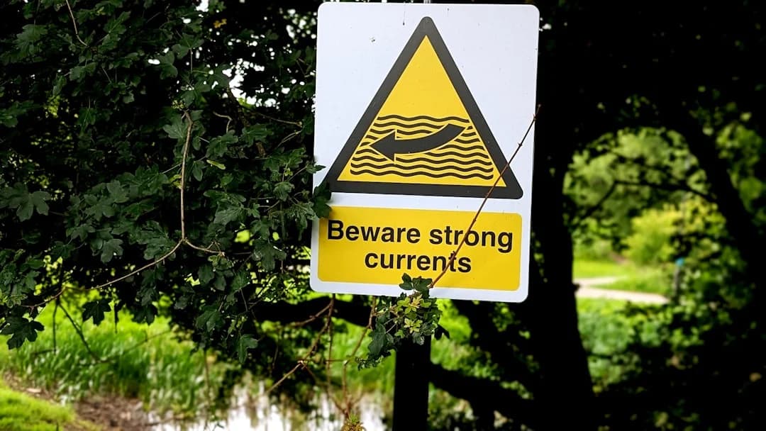
Sailing in Strong Currents: Tides, Tools, Examples
Tidal current isn’t “free speed” or “annoying drag.” It’s a moving conveyor belt that changes your steering margin, your stop distance, your ability to hold a narrow track, and—if you get it wrong—your options. This is a practical method for sailing in strong currents that I’ve used in the Solent, the Channel, and the Northeast US: separate tidal height vs tidal stream, set a current budget, compute set and drift with simple vectors, and time tide gates with UKHO atlases or NOAA stations.
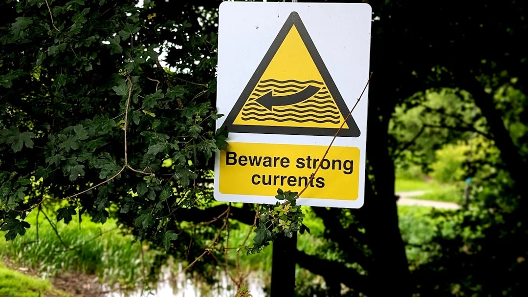
Photo by Pixel Shot on Unsplash
Why strong currents change everything (SOG, control, and a “current budget”)
A strong current doesn’t just move your ETA around. It changes what the boat can physically do in the next 60 seconds: can you turn inside the channel, can you stop before the bridge abutment, can you hold the leading line, and can you avoid being “set down” onto a shoal. That’s why current planning is seamanship, not spreadsheet work.
The first trap is confusing SOG (speed over ground from GPS) with STW (speed through water from the log). You can have 6.0 kt SOG with 4.0 kt of fair current and only 2.0 kt STW—meaning lousy rudder authority in steep chop and very little control if you need to dodge a pot buoy or a ferry. GPS makes the day look heroic right up until the boat stops answering the helm near an obstruction.
So I plan with a repeatable current budget, the same way I plan fuel and daylight. Before departure, I set limits: minimum acceptable SOG (often 2.5–3.0 kt in confined water), maximum adverse current I’m willing to accept, and a maximum cross-track error I’ll tolerate in a channel (a 2 kt cross-current is already a handful if the channel is narrow). I also set a turn-back point tied to the last safe harbor or anchorage—because “we’ll see how it goes” is not a plan.
Here’s the rule-of-thumb that keeps people out of trouble: when opposing current exceeds ~50% of your motoring STW, the current becomes “dominant,” and your margins collapse fast. If you motor at 6 kt STW and punch into 3 kt adverse stream, you’re now at ~3 kt SOG before wind, waves, and leeway take their share. A 35–40 ft cruiser typically burns 0.7–1.2 US gph at 5.5–6.5 kt, so a foul stream can double time and roughly double fuel for the same sea distance—one reason it’s worth using a tool to estimate your fuel needs based on the voyage distance before you commit.
Strong current also intersects pilotage realities: narrow channels, bridge windows, ferry routes, and traffic flows that don’t care about your “perfect tack.” In those places, your current budget is your go/no-go tool, and it’s worth more than any fancy routing feature. It also helps to calculate the distance between ports to sanity-check legs and see how a 2–3 kt stream changes time and fuel before you cast off.
Tip: Build a current budget before departure
- Minimum SOG in confined water: 2.5–3.0 kt
- “Dominant current” trigger: adverse stream >50% of motoring STW
- Cross-current limit for narrow channels: around 2 kt unless it’s wide, clear, and you have room to crab
- Pre-brief a turn-back point tied to the last safe refuge and a fuel reserve margin
Set, drift, leeway, and course-to-steer (worked numeric methods onboard)
Vector thinking without the math degree: what you need to measure
Set and drift are just the current’s vector: set is the direction the water pushes you (degrees True), and drift is its speed (knots). Your boat’s STW vector (from the log and heading) combines with the current vector to produce your actual track and SOG (from GPS). You don’t need calculus; you need consistent units and a willingness to adjust early.
Don’t mix up leeway vs set. Leeway is the boat sliding sideways through the water from wind and sea state; set is the water mass moving over the ground. Upwind cruising leeway might be 3–8°, and in strong stream you often have both leeway and set working against your desired track. If you ignore either one in a narrow place, you’ll end up “correcting” with bigger and bigger helm until you run out of channel.
A practical onboard workflow is: choose a desired track, get predicted set/drift for the time window, assume a realistic STW for the sail plan or motoring RPM, then compute a crab angle and add a leeway allowance. In 4–8 kt streams, a 30-minute timing error can flip 2–4 kt of advantage into pain, so I plan in 15–30 minute blocks rather than “sometime after breakfast.”
Worked example: holding a track with cross-current (crab angle)
The quick rule is: crab angle ≈ arctan(cross-current / STW). Example: STW 5.5 kt, cross-current 2.0 kt gives arctan(2/5.5) ≈ 20°. That means if your desired track is 060°T, you might steer roughly 040°T (or 080°T depending on which way the current sets) before leeway.
Now add realism. If you’re close-hauled and expect 5° leeway, you don’t get to pretend that 20° correction is the whole story. You may need something like 25° total offset to hold a tight track, then adjust based on observed COG. The good news is you don’t have to be perfect—just early—because small errors grow slowly offshore and violently in a dredged cut with a rock edge.
A handy refinement is to compute the current component along your track for ETA. If your track component of current is +1.5 kt, and your STW is 5.5 kt, you can expect roughly 7.0 kt SOG on that leg. If it’s -1.5 kt, plan for 4.0 kt SOG, and accept that your fuel and daylight plan just changed.
Diagnosing sensor error: heading/COG/STW sanity checks
When things don’t add up, don’t assume “mystery currents” first—assume instruments. If your log is fouled and reading 1–2 kt low, your crab angle math will be wrong and you’ll chase the track like a drunk shopping cart. If your heading sensor is misaligned by 10°, you’ll swear the atlas is wrong, then discover the sensor is.
Use a quick reconciliation: compare heading vs COG and STW vs SOG. Large, stable divergence between heading and COG with steady STW usually indicates consistent set; wildly changing COG with similar SOG suggests eddies and shear. If STW looks too low for the RPM and wake, clean the paddlewheel or switch to an estimated STW and steer by transits until you trust the numbers again.
Tidal height vs tidal stream: Rule of Twelfths, corrections, and UKC math
Rule of Twelfths: when it works—and when it lies
Tidal height tells you if you’ll float; tidal stream tells you where you’ll end up. Confusing them causes two classic errors: grounding because you assumed “it’s near high water,” or missing a gate because you assumed “slack water equals high water.” In many places slack occurs hours away from HW/LW, and local geography can skew both timing and magnitude.
The Rule of Twelfths is a quick approximation for semi-diurnal tides: over the six hours from low water to high water, the rise is 1-2-3-3-2-1 twelfths of the total range (then reverse on the ebb). It’s useful when you need an estimate on deck and don’t have time to interpolate. It is not a license to cut depth margins fine in shallow water with weather effects.
It fails when shallow-water harmonics, local geography, or weather surge distort the curve. A 0.5 m pressure or wind-driven surge is enough to ruin a “just enough” clearance plan, and strong onshore wind can change local heights and streams in ways tide tables won’t predict. In big-range areas—think Bay of Fundy up to ~16 m / 52 ft—height changes can be rapid enough that a mooring field becomes a drying flat between lunch and dinner.
Under-keel clearance: depth, height of tide, squat, and waves
UKC math should be repeatable and boring. Start with charted depth, add height of tide, subtract draft, then subtract allowances for squat and waves. Example: draft 3.5 m, charted depth 4.2 m, tidal height +1.0 m gives UKC = 4.2 + 1.0 − 3.5 = 1.7 m before margins.
Now add a margin that matches the conditions. In fast, shallow water I routinely allocate 0.3–1.0 m depending on speed, seabed, and chop, because squat and wave troughs are real and they don’t negotiate. Following current can tempt you to motor faster for steerage, but speed increases squat, and squat doesn’t care that you were “making time.”
Secondary port corrections matter here too. UKHO/RYA-style publications give timing and height differences from a reference port; if you skip them, your “+1.0 m” might actually be +0.6 m at the place you’re entering. That’s not an academic difference if you’re aiming for 0.5 m UKC.
Large-range realities (Bay of Fundy-style planning mindset)
Large tidal range is less about bragging rights and more about consequences. A harbor with 4.2 m charted depth might be comfortable at HW and impassable at LW, and strong flows can run where the range is forced through a constriction. The safe mindset is to plan the “bottom of the trough,” not the predicted average—because waves, squat, and timing errors all subtract from UKC.
If you’ve never sailed big-range water, treat it like mountain weather: conditions change faster than your habits. You plan your entrance window, your exit window, and your Plan B for “we’ll wait another cycle.” It’s better to drink bad marina coffee for two hours than to learn what your keel sounds like on hard sand.
UK-style workflow: tide tables + tidal stream atlas + almanac (and what it costs)
How UK tidal stream atlases are indexed (HW reference ports)
The classic UK method is still the best: Admiralty Tide Tables for heights and times, UKHO Tidal Stream Atlas for set/drift by hour, and Reeds or Imray for pilotage notes and secondary port corrections. It’s not old-fashioned; it’s structured, and it matches how the data is published in UK waters.
A stream atlas is indexed to a reference port’s high water, and each page shows hourly vectors like HW+0 to HW+6. You’ll see arrows (set in degrees True) and rates (drift in knots) across the area, and you pick the numbers closest to your track. That’s why you can plan a headland at “HW Portsmouth +2” instead of guessing based on the tide height curve.
In places like the Solent, typical streams are 2–4 kt, with localized peaks around ~4 kt at Hurst Narrows on springs. That’s strong enough that a small timing slip or a misread arrow puts you on the wrong side of a buoy line surprisingly fast. Use the atlas to anticipate the set before you feel it.
Building a simple passage plan from HW± vectors
The practical method is: pick the gate, choose the favorable stream window, then work backward to a departure time using assumed STW. If your boat motors at 6.0 kt STW, and you expect +2.0 kt fair current on the key leg, you can plan around 8.0 kt SOG there—then be conservative on the legs with cross-set and traffic.
This is where plan your route using a sea distance calculator earns its keep. Use it to get accurate leg distances, then compute time with SOG assumptions that include current components. When the plan says you’ll arrive at the narrows at HW+1:30, you can check whether that’s actually “fair stream” in the atlas, or whether you’ve planned to meet the worst of it because you liked a tidy spreadsheet.
The last part is human: brief the crew on the gate time, the expected set, and the abort option. In my notebook I’ll write a hard line like “If SOG < 3.0 kt at the outer mark, turn back to X,” because it stops the slow-motion argument later.
Paper vs digital redundancy for tidal pilotage
Digital current layers are excellent until they aren’t. Batteries die, plotters reboot, and phone screens don’t love salt spray; ABYC E-11 is the reason a properly fused and wired power system matters when you’re in fast water and need GPS, VHF, and depth to stay alive. I like paper tide times and at least one paper stream reference, even if I execute on a plotter.
Here’s what the UK tool stack typically costs, and why I still carry it:
| Tool | Typical use | Price range |
|---|---|---|
| UKHO Admiralty Tide Tables (NP201–NP204 region-dependent) | HW/LW times + heights at standard ports | £35–£55 |
| Admiralty Tidal Stream Atlas (regional) | Hourly set/drift vectors relative to HW | £20–£40 |
| Reeds Nautical Almanac / Reeds Channel Almanac | Secondary port corrections + pilotage notes | £45–£60 |
| Imray chart packs | Charts + notes for cruising area | £35–£80 |
NE US-style workflow: NOAA currents, local pilots, and timing constrictions
NOAA current stations: what the predictions do (and don’t) say
In the Northeast US, the backbone is NOAA: predicted currents at named stations with times and speeds for max flood/ebb and slack. The key is remembering what NOAA is actually predicting: conditions at that station, not everywhere within three miles. In places like the East River or canal entrances, micro-geography makes the difference between a clean ride and a sideways wrestling match.
Hell Gate/East River peak currents are commonly cited around 4–5 kt, and Cape Cod Canal peaks are roughly 4–5 kt as well. Those aren’t “interesting numbers”; they’re big enough to invalidate your boat’s normal maneuvering distances, and they can turn a simple bridge timing into a missed slot and a long wait. When the stream is near peak, small errors get expensive.
NOAA gives you a time series you can plan around, but you still need local pilotage notes for eddies, shoal edges, and turbulence around structures. If you run a boat through Hell Gate at max ebb with wind against it, you’re volunteering for a lesson you didn’t request.
From station to track: applying set/drift to an actual leg
Use the station prediction to select your window—often aiming for fair current or near-slack depending on the place and your boat. Then translate that into a leg plan: expected set direction, expected drift, and what it does to your SOG and track-keeping. If your boat does 6.0 kt STW and the canal gives you +4.0 kt, your SOG can touch 10 kt, which sounds fun until you realize your stopping distance is now measured in zip codes.
For a practical ETA, compute time = distance / SOG, and treat cross-current separately as a steering problem. Breezada’s sea distance calculator is useful here for gate-to-gate distances, then you can see what a 2 kt difference in current does to arrival time. In fast water, an “I’ll be there around noon” plan is how you arrive at peak adverse current, tired and irritated.
Handling uncertainty: wind setup, runoff, and eddy fields
NOAA predictions don’t fully account for wind setup, river runoff, or localized turbulence. A sustained 20–25 kt wind can steepen the sea state and change how comfortable—and controllable—the boat is, especially with wind against ebb creating standing waves and confused chop. Near bridge abutments, expect sharp shear zones and rotating eddies, even when the station prediction looks polite.
My minimum toolchain in these areas is simple: GPS SOG/COG, depth sounder, VHF, and ideally AIS in traffic-heavy water. A chartplotter or app current layer helps, but the real steering is still done by transits and “what the boat is actually doing right now.” Set hard abort points before you commit to the narrow, fast segment, and treat them as a safety system, not a mood.
Real ‘tide gate’ planning examples (Solent/Channel + NE US), with Plan B
Example A (UK): Solent strong tide—timing, ferry-glide, and escape options
Objective: transit a narrow, traffic-heavy stretch with strong stream and hold the buoyed channel. Constraints: ferries, limited room to drift, and localized ~4 kt at Hurst Narrows on springs with typical Solent streams 2–4 kt. Assumed boat speed: 5.5 kt STW under power for control and schedule.
Plan: aim to arrive with favorable or moderate stream, not at peak adverse. If the stream sets across the channel at 2.0 kt, crab angle is arctan(2/5.5) ≈ 20°, then add 3–5° leeway if there’s wind and chop. That’s why the boat may be pointing one compass quadrant away from the track while still staying neatly between marks.
Plan B: identify a waiting/holding area with adequate depth at that state of tide, and a retreat harbor that’s reachable without having to claw back through the narrows. Decision trigger: if SOG drops below 3.0 kt approaching the constriction, or you can’t hold within your cross-track limit, turn early—because turning late is how you meet the ferry while sideways.
Example B (UK/Channel): Portland Bill as a gate (overfalls avoidance window)
Objective: pass the Bill without getting trapped in overfalls and adverse stream. Constraints: very strong tidal streams, with pilotage sources commonly citing 5–7 kt peaks depending on springs/neaps and how close inshore you go. Standing waves and overfalls are most unpleasant when wind opposes the stream, and they build fast over uneven bottom.
Plan: treat it as a timing gate, not a “we’ll see how it looks” headland. Choose an offshore distance appropriate to conditions and boat category (ISO 12217 stability category is not trivia when short, steep seas appear), and aim for the favorable part of the cycle. If you miss the window by 30 minutes in a 6 kt regime, you can easily give away 2–4 kt of advantage and end up bashing with poor control.
Plan B: a delay option outside the race, or an alternate route that avoids the worst overfalls, depending on wind direction and sea state. Benchmark reminder: the Alderney Race is often cited at 7–9 kt on springs, and it’s a good mental reference for “don’t improvise here.” If you wouldn’t wing it in Raz Blanchard, don’t wing it at Portland Bill when it’s white and roaring.
Example C (NE US): Hell Gate or Cape Cod Canal—station timing to ETA
Objective: transit a constriction efficiently and safely using NOAA predictions. Constraints: peak currents around 4–5 kt, turbulence near structures, and heavy traffic. Assumed boat speed: 6.0 kt STW motoring for reliable control, with a minimum SOG target of 3.0 kt if things go sideways.
Worked mini-calculation (fuel/time): say you have 12 nm to a gate. With fair current of +2 kt, expected SOG ≈ 8 kt, time ≈ 1.5 hours; with -2 kt adverse, SOG ≈ 4 kt, time ≈ 3 hours. At 0.7–1.2 gph, that’s roughly 1.1–1.8 gal vs 2.1–3.6 gal, before you add detours and maneuvering—this is why current planning is fuel planning.
Plan B: if you arrive early, wait in a designated area with room and depth; if you arrive late and the stream is near peak adverse, delay rather than “forcing it.” In both Hell Gate and the Canal, your abort option gets worse the deeper you commit, so decide your turn-back point before you enter the funnel. Use Breezada’s sea distance calculator to validate the distances you’re using to back-calculate departure time, because being off by even 1–2 nm matters when the stream turns on a schedule.
Risk management in rips, overfalls, and narrow channels (rules + decision points)
Wind-against-tide mechanics: where standing waves form
Overfalls and tide rips form where fast current runs over uneven bottom, shoals, or headland edges, especially with opposing wind or swell. The water piles up, steepens, and can break in lines that look like someone drew them with chalk. It’s not always dramatic from a mile away, which is why people blunder in and only then notice the “roaring sound” and the boat slamming like it’s trying to void your warranty.
Practical cues: abrupt wave steepening, breaking lines, confused cross-seas, and debris or pot lines marking shear zones. The edge of a race can have sharp gradients; one boatlength you’re fine, the next you’re sideways. If the current is 5–7 kt (Portland Bill-style), your correction needs to be proactive, not reactive.
Rules and obligations when maneuverability is constrained
Strong current often coincides with constrained water, so the Navigation Rules aren’t optional reading. USCG/COLREGS Rule 6 (Safe Speed), Rule 5 (Look-out), and Rule 7 (Risk of Collision) matter more when your ability to maneuver is reduced by set and drift. Rule 9 (Narrow Channels) is the one people break when they get set across and try to “borrow” the wrong side to fix it.
In TSS areas, Rule 10 applies, and the current doesn’t excuse a sloppy crossing angle. If spray or fog reduces visibility near rips, make sure lights and sound signals are compliant (33 CFR 83/84, COLREGS Annex I). The current will happily push you into close-quarters while you’re still arguing about who had right of way.
Practical abort criteria and communications
Use decision points that are measurable. If adverse current is >50% of your motoring STW, expect shrinking VMG and control margin; if your SOG drops below your minimum (often 2.5–3.0 kt in tight water), don’t keep donating distance to the bad idea. Pre-brief the crew: what you’ll do if the gate is missed, where you’ll wait, and what “abort” looks like on deck.
Communications reduce surprises. Monitor the correct VHF channel in traffic-heavy constrictions, and make a securité call when appropriate in narrow, fast water where meeting situations develop quickly. AIS helps you predict the “where will we be in 6 minutes” problem, but it does not replace eyeballs—especially when ferries and tugs are doing ferry and tug things.
Close-quarters handling in current: docking, moorings, anchoring, and instruments
The default in current is simple: approach into the current when you can, because it reduces SOG and improves control. In 2–4 kt (Solent-style), approaching with the current can turn a normal landing into a slide you can’t stop, especially if you’re heavy and the prop is aerating in chop. If you can’t stop and turn within the available box, you’re already late to go around.
Cross-current docking often needs a ferry-glide rather than a straight-line approach. Pick an angle that holds you off the dock while you creep forward, then “step” sideways in control, watching your COG and a fixed reference ashore. Prop walk becomes more noticeable under high rudder load, so plan which way the stern will kick when you go into reverse, and don’t pretend it’ll behave differently today.
Mooring pickup in 2–4 kt is a crew choreography exercise. Approach slowly into current, keep just enough power for steerage (often ~1.5–2.5 kt SOG depending on boat), and assign roles so nobody improvises with fingers near loaded lines. The big hazard is being set down onto other boats while you’re distracted by the pennant, so keep an exit lane and call the abort early.
Anchoring in current needs extra thought because the load direction reverses at slack. Use adequate scope for the depth and conditions, set the anchor with a consistent load, and anticipate the swing when the tide turns. If you’re in a high-risk tidal harbor, good seacock condition (ABYC H-27) matters because a grounding or debris strike in strong flow can turn into an unwanted water feature inside the boat.
Instrument priorities in tight water are: depth, COG/SOG, and visual transits. Manage alarms so they warn rather than nag, and make sure your power system keeps plotter/VHF alive when you need them—ABYC E-11 is the reference point for proper fusing and wiring practices, and it’s written in the blood of bad installations. When strong current meets close quarters, “the plotter rebooted” is not a funny story.
Frequently Asked Questions
How do I compute a course-to-steer when the tidal stream is given as “HW Portsmouth +3, 2.5 kt setting 090°T” and my target track is 060°T at 5.5 kt STW?
Break the 2.5 kt current into components relative to your 060°T track. The angle between set 090°T and track 060°T is 30°, so the cross-current ≈ 2.5 × sin(30°) = 1.25 kt, and the along-track component ≈ 2.5 × cos(30°) = 2.17 kt (helping if it’s generally in your direction). Crab angle ≈ arctan(1.25/5.5) ≈ 13°, then add any leeway (often 3–8° upwind) to hold a tight track.
What’s the fastest onboard method to estimate set and drift from instruments using heading, STW, COG, and SOG—without plotting for 30 minutes?
Steer a steady heading for a few minutes in consistent water, note heading + STW and COG + SOG, and treat the difference as the current vector. If heading and COG diverge by a stable amount while STW stays steady, you have consistent set; if COG swings while SOG stays similar, you’re in eddies or shear. Sanity-check the log: a fouled paddlewheel can be 1–2 kt wrong and will make your estimated set/drift look “mysteriously” large.
When using NOAA current predictions for Hell Gate, how should I adjust timing if I expect 20–25 kt wind against the ebb and localized turbulence near bridge abutments?
Plan for reduced control and a slower effective transit even if the station still predicts the same peak 4–5 kt. With 20–25 kt wind against ebb, expect steeper standing waves, more yaw, and more need to stay in the cleanest part of the stream rather than the shortest line. I bias toward a more favorable window (closer to slack or early fair current), and I set a stricter abort trigger such as minimum 3.0 kt SOG and a defined turn-back point before entering the worst constriction.
How much UKC margin should I add for squat when motoring at 6.5 kt in a dredged channel with strong following current, and how does that differ from slack water assumptions?
In small craft planning, a practical margin is often 0.3–1.0 m depending on speed, seabed, and chop, and I push toward the higher end when moving fast in shallow water. A strong following current tempts higher SOG, but squat depends on speed through water and flow dynamics, and wave troughs can subtract more depth than you think. At slack water you can sometimes accept a smaller margin, but in strong current I assume more uncertainty and avoid planning to “just scrape through.”
How do tidal stream atlas vectors (hourly relative to HW) break down near springs/neaps, and what’s a practical way to bound the error for a 30-minute timing slip?
Atlas vectors are typically generalized and presented hourly relative to HW at a reference port (HW+0 to HW+6), and real streams vary with springs/neaps, wind effects, and micro-geography. In fast areas—say 4–8 kt streams—a 30-minute timing slip can swing you by ~2–4 kt between favorable and adverse in the steep part of the curve. The practical bound is to plan in 15–30 minute increments, compare adjacent atlas hours, and assume you might experience something closer to the worse of the two if you’re near peak.
Conclusion
Sailing in strong currents is a repeatable process: separate height from stream, build a current budget, compute set/drift with simple vectors, and use the regional tools that match the water—UKHO tidal stream atlases in the UK, NOAA current stations in the NE US. The real safety gain comes from quantified limits (minimum SOG, minimum UKC, maximum cross-track error), tool redundancy, and a pre-briefed Plan B for every constricted segment where the current gets a vote.
About the Author
Related Articles
NAVTEX for Sailing: SafetyNET Offshore Weather Guide
Learn NAVTEX & SafetyNET (Inmarsat-C) setup, filters, and what MSI to trust offshore. Get clearer forecasts—read the guide now.
By Breezada Team
Sailboat Hull Speed: Calculate It and Exceed It
Learn sailboat hull speed, the 1.34×√LWL formula, and when boats can exceed it. Get examples and tips—read now and calculate yours.
By Breezada Team
Sailing Right of Way Rules: COLREGs Made Simple
Learn sailing right of way rules with simple COLREGs scenarios—tack, overtaking, crossing, lights, and priority exceptions. Read & use the cheat sheet.
By Breezada Team

How to Read GRIB Files for Sailing and Avoid Errors
Read the guide and start sailing smarter today. Explore key tips, gear, and routes—click to learn more.
By Breezada Team