The Canary Islands sit roughly 60 nm off the coast of Morocco, seven volcanic islands strung across about 250 nm of Atlantic Ocean. Sailing between them means open-ocean passages — not sheltered hops between coves — with trade winds that blow reliably from the northeast for most of the year. That combination of steady wind, warm water, and dramatic volcanic scenery makes the archipelago one of the best cruising grounds in the Atlantic, but it demands more respect than the calm-water island hopping you might be used to in Greece or Croatia.
Photo by Daria Nepriakhina 🇺🇦 on Unsplash
The Seven Islands — A Quick Orientation
From east to west, the main islands are Lanzarote, Fuerteventura, Gran Canaria, Tenerife, La Gomera, La Palma, and El Hierro. Most charter fleets and marinas concentrate on the central islands — Tenerife, Gran Canaria, and Lanzarote — while the western trio of La Gomera, La Palma, and El Hierro sees fewer yachts and feels genuinely remote.
The islands sit in the path of the northeast trade winds, which funnel and accelerate through the channels between them. This creates a sailing environment where the wind is rarely below 15 knots in the channels and regularly pushes past 25 knots — especially in the notorious canal between Tenerife and Gran Canaria, where wind acceleration effects can push gusts above 35 knots even on otherwise moderate days.
Understanding this acceleration effect is the single most important piece of local knowledge. The high volcanic peaks — Mount Teide on Tenerife reaches 3,718 meters — create wind shadows on the lee side and compression zones at the island edges. You can go from 8 knots of breeze in the shadow of Tenerife to 30 knots within two miles.
Inter-Island Routes and Distances
Here's a breakdown of the main passages. You can calculate the exact distance between any two Canary Island ports to plan your own itinerary, but these are the routes most cruisers sail.
| Route | Distance (nm) | Typical Duration | Key Challenge |
|---|---|---|---|
| Lanzarote → Fuerteventura | 6–12 | 1–2 hours | Shallow strait, ferry traffic |
| Fuerteventura → Gran Canaria | 52 | 6–8 hours | Open ocean, building seas |
| Gran Canaria → Tenerife | 40 | 5–7 hours | Wind acceleration in channel |
| Tenerife → La Gomera | 20 | 3–4 hours | Abrupt wind shifts at lee edge |
| La Gomera → La Palma | 48 | 6–9 hours | Longest western passage, swell |
| La Palma → El Hierro | 40 | 5–7 hours | Remote, limited shelter |
| Tenerife → La Palma (direct) | 80 | 10–14 hours | Overnight passage typical |
Photo by Eric Prouzet on Unsplash
Eastern Islands: Lanzarote and Fuerteventura
The Strait of La Bocaina between Lanzarote and Fuerteventura is the easiest passage in the archipelago. At its narrowest, it's about 6 nm, and the water is relatively sheltered compared to the open channels farther west. The main hazard is commercial ferry traffic — the Fred Olsen and Armas ferries run frequently and move fast.
Marina Rubicón in southern Lanzarote is the best-equipped marina in the eastern islands, with 500 berths and full services. On Fuerteventura, Puerto del Rosario and Gran Tarajal offer decent facilities, though neither matches Rubicón for comfort.
The sailing here tends to be lighter than farther west. Fuerteventura and Lanzarote are low-lying compared to the western islands, so the trade winds pass over them rather than compressing around them. Expect 12–20 knots on a typical day — pleasant sailing by any measure.
The Central Channel: Gran Canaria to Tenerife
This is the passage that earns the Canaries their reputation. The canal between Gran Canaria and Tenerife is roughly 40 nm across, and the combined effect of both islands' terrain funnels the trade winds into a jet that regularly exceeds 25 knots. Seas of 2–3 meters are normal; 4 meters is not unusual.
The standard strategy is to leave early — ideally before dawn — from Gran Canaria's south coast. The thermal effects haven't kicked in yet, and you can make the crossing before the wind peaks in early afternoon. If you're heading west, the wind is usually on your beam or quarter, which makes for fast, wet sailing.
Las Palmas de Gran Canaria is the main hub: a major marina with excellent boatyards, chandleries, and a community of liveaboard cruisers — many of them staging for the ARC transatlantic rally each November. On Tenerife, Marina del Sur (Las Galletas), Marina San Miguel, and Santa Cruz de Tenerife are the primary options.
If you're debating what type of boat to take on these passages, our monohull vs catamaran comparison breaks down the practical trade-offs — and the Canaries' steep, short seas are one scenario where each hull type shows its character distinctly.
Western Islands: La Gomera, La Palma, El Hierro
The western islands are the reward for sailing through the central channels. La Gomera — just 20 nm from Tenerife's south coast — is often the first stop, and San Sebastián de la Gomera has a well-run marina that's been welcoming transatlantic sailors for centuries. Columbus provisioned here before crossing the Atlantic, and the town still feels like a departure point for somewhere wilder.
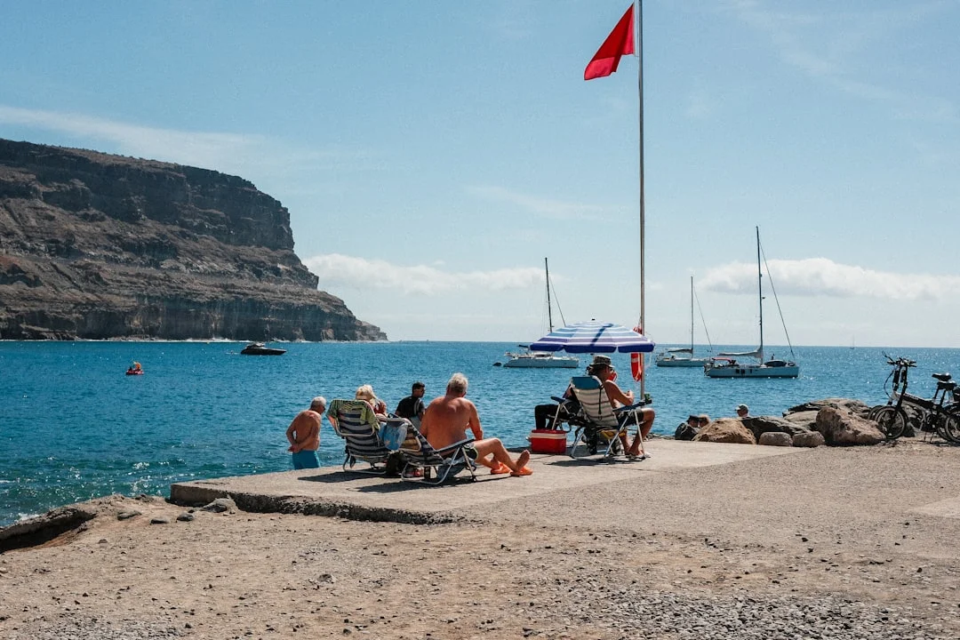
Photo by Dhiemas Afif Febriyan on Unsplash
La Palma is 48 nm from La Gomera, a genuine open-ocean passage with Atlantic swell rolling in from the northwest. The island's marina at Santa Cruz de la Palma is small but charming, tucked beneath steep green mountains. La Palma is also where you'll find some of the archipelago's best anchorages — Puerto de Tazacorte on the west side is sheltered from the trades and backed by banana plantations.
El Hierro, the smallest and most remote of the main islands, sits 40 nm south-southwest of La Palma. The marina at La Restinga has limited berths, and the island receives very few visiting yachts. That's part of its appeal. The diving here is world-class, and the volcanic scenery is raw and unpeopled.
When to Sail the Canary Islands
The Canaries are a year-round sailing destination, but conditions vary significantly by season.
November through March is prime season. The trade winds are most consistent, typically 15–25 knots from the northeast. Air temperatures hover around 20–24°C, water around 19–20°C. This is also when the ARC fleet passes through Las Palmas, and the cruising community is at its largest.
April through June sees lighter winds — sometimes dropping below 10 knots — and calmer seas. This is the best window for less experienced crews or for visiting the western islands, where the lighter conditions make the longer passages more comfortable. If you are sailing with children during these months, our guide to the best summer sailing destinations for families covers calmer alternatives in the Mediterranean that suit younger crews.
July through October brings the calima — hot, dusty winds from the Sahara that can reduce visibility to under a mile and coat every surface in fine sand. The trades remain but can become gusty and unpredictable. Late summer also brings the theoretical risk of tropical storms, though they rarely affect the Canaries directly.
For those planning a broader Atlantic itinerary, you might find it helpful to read our passage guide from Gibraltar to the Canary Islands — it covers the approach, timing, and what to expect on the 600 nm run south.
Practical Tips for Sailing the Canary Islands
Passage Planning and Wind Acceleration
Always check the wind forecast for the specific channel you're crossing, not just the general area forecast. AEMET (Spain's meteorological agency) issues marine forecasts for each inter-island channel. The difference between the open ocean forecast and what happens between two islands can be 15+ knots.
Use Breezada's sea distance calculator to verify distances between waypoints. This matters because the wind shadow on the lee side of each island creates a zone of calms — sometimes several miles wide — that can add hours to a passage if you don't account for it. Some sailors motor through the calm patches; others angle farther offshore to stay in the breeze.
Anchorages and Shelter
True sheltered anchorages are scarce. The Canaries don't have the enclosed bays you find in the Mediterranean. Most anchoring is in open roadsteads on the lee side of islands, exposed to swell that wraps around from the north.
The best anchorages include:
- Playa de las Teresitas, Tenerife — sand-bottomed, sheltered from the trades
- Puerto de Tazacorte, La Palma — west coast, calm in normal trades
- Playa Francesa, La Graciosa — north of Lanzarote, good in settled conditions
- Puerto de Mogán, Gran Canaria — the "Venice" of the Canaries, well-sheltered harbor
- Valle Gran Rey, La Gomera — dramatic cliffs, anchorage in settled weather
Holding is generally good in sand, poor in volcanic rock. Carry plenty of chain — the depths can change abruptly near volcanic shorelines, and you may need 5:1 scope where you'd normally use 3:1.
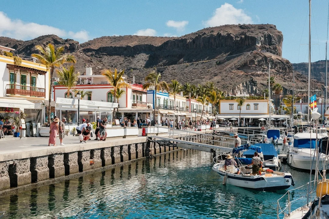
Photo by Dhiemas Afif Febriyan on Unsplash
Chartering vs. Bringing Your Own Boat
Charter bases are concentrated in Las Palmas (Gran Canaria) and Marina del Sur (Tenerife). A few smaller operators run out of Lanzarote. Expect to pay €2,000–€4,500/week for a 38–45 ft monohull in high season, depending on age and equipment. Catamarans run roughly 40–60% more.
Charter companies in the Canaries tend to be more restrictive about inter-island passages than you might expect from a Mediterranean charter. Some limit you to day sailing from the base; others require documented offshore experience (an ICC or RYA Day Skipper at minimum) before they'll authorize inter-island crossings. Ask before you book.
If you're bringing your own boat, Las Palmas is the natural entry point. The marina has hauling facilities up to 75 tons, several chandleries, and a community of cruisers who've been maintaining boats in the Canaries for years. It's also a reasonable place to leave a boat on the hard during summer if you plan to return.
Provisioning and Services
Provisioning is straightforward on the four main islands. Mercadona and HiperDino supermarkets are everywhere, with good-quality fresh produce, local cheeses, and excellent wine (try Malvasía from Lanzarote). Gas and diesel are available at all major marinas, typically cheaper than mainland Spain.
The western islands are more limited. La Gomera and La Palma have small supermarkets, but don't count on finding specialty items or marine parts. El Hierro has one small supermarket in Valverde and essentially no marine services.
Navigation Hazards
A few things to watch for:
- Fish farms — numerous around Gran Canaria and Tenerife's south coast, not always well-lit
- Ferry traffic — high-speed ferries crossing the channels; they're fast and don't deviate
- Volcanic rock close inshore — charts may not show every pinnacle, especially off El Hierro
- Whale and dolphin populations — the channels between the islands are rich cetacean habitat. Slow down if you see them; collisions happen
A Suggested Two-Week Itinerary
For a two-week charter or cruise starting and ending in Las Palmas:
Week 1: East to Central
- Day 1: Las Palmas — settle in, provision, check boat
- Day 2: Las Palmas → Puerto de Mogán (30 nm, coastal sail along Gran Canaria's south coast)
- Day 3: Puerto de Mogán — rest day, the harbor is worth lingering in
- Day 4: Puerto de Mogán → Marina del Sur, Tenerife (40 nm, early start for the channel crossing)
- Day 5: Tenerife — rent a car, drive up to Mount Teide
- Day 6: Marina del Sur → San Sebastián de la Gomera (20 nm, afternoon passage)
- Day 7: La Gomera — hike Garajonay National Park, a UNESCO World Heritage laurel forest
Week 2: West and Return
- Day 8: San Sebastián → Valle Gran Rey, La Gomera (coastal sail, 15 nm)
- Day 9: Valle Gran Rey — rest, swim, provisions
- Day 10: Valle Gran Rey → Santa Cruz de la Palma (60 nm, long day sail or overnight)
- Day 11: La Palma — visit the volcanic crater, Puerto de Tazacorte
- Day 12: Santa Cruz de la Palma → San Sebastián de la Gomera (48 nm, return east)
- Day 13: San Sebastián → Las Palmas (60 nm via Tenerife's south coast, long day)
- Day 14: Buffer/rest day, boat return
This is ambitious. A more relaxed version would skip La Palma and spend extra days in La Gomera and Tenerife. You can verify distances between any of these ports to adjust the itinerary to your crew's sailing speed and comfort level.
Safety Considerations
Sailing the Canary Islands is not technically difficult, but the conditions demand a crew that's comfortable in open water. The biggest risks are:
- Underestimating wind acceleration in the channels — this catches more visiting sailors than anything else
- Fatigue on multi-day itineraries — the passages are rarely dangerous, but they're physical, and crews that push too hard make mistakes
- Limited bail-out options — once you're committed to a channel crossing, the nearest shelter might be 3–4 hours away
- Night arrivals — avoid arriving at unfamiliar ports after dark; fish farms and poorly lit rocks make this risky
Carry a VHF radio and monitor Channel 16. The Spanish Maritime Rescue Coordination Centre (Salvamento Marítimo) covers the Canaries and responds quickly. Mobile phone coverage is good near the islands but drops off quickly once you're 10+ nm offshore.
Frequently Asked Questions
How long does it take to sail between the Canary Islands?
Passages between adjacent islands take 3 to 9 hours depending on the route. The shortest crossing — Lanzarote to Fuerteventura — is about 6 nm and takes roughly an hour. The longest commonly sailed passage — La Gomera to La Palma — is 48 nm and takes 6 to 9 hours depending on conditions. Crossing from Tenerife directly to La Palma is about 80 nm and many crews do it as an overnight sail.
What sailing experience do I need for the Canary Islands?
You need solid offshore experience — this is not a beginner's destination. At minimum, you should be comfortable sailing in 20–25 knots of wind with 2–3 meter seas. Most charter companies require an ICC (International Certificate of Competence) or equivalent qualification, plus documented offshore miles. If you're newer to sailing, consider hiring a local skipper for the channel crossings and keeping your independent sailing to the sheltered eastern islands.
Can I sail the Canary Islands year-round?
Yes. The Canaries have a year-round sailing season, which is one of their biggest advantages. November through March offers the strongest and most consistent trade winds — ideal for experienced sailors. April through June brings lighter conditions, better for less experienced crews. July through October is warmest but can bring the calima (Saharan dust) and more unpredictable wind patterns. There's no off-season in the traditional sense, though summer brings fewer cruising yachts.
What are the main marinas in the Canary Islands?
The principal marinas are Las Palmas de Gran Canaria (the largest, with full boatyard services), Marina Rubicón (Lanzarote), Marina del Sur and Marina San Miguel (southern Tenerife), San Sebastián de la Gomera, and Santa Cruz de la Palma. Berthing costs range from about €15 to €40 per night for a 40 ft yacht, depending on the marina and season. Las Palmas is the most affordable for long-term stays and the best-equipped for repairs.
Is it safe to anchor in the Canary Islands?
Anchoring is possible but requires more caution than in the Mediterranean. Most anchorages are open roadsteads on the lee side of islands, which means some swell usually wraps around. The best holding is in sandy patches — volcanic rock provides poor grip. Good anchorages include Playa de las Teresitas (Tenerife), Puerto de Tazacorte (La Palma), and Playa Francesa (La Graciosa). Always check the forecast for swell direction before committing to an anchorage, and be prepared to move to a marina if conditions change overnight.
About the Author
Related Articles
Puget Sound Cruising Guide to Gulf Islands Routes
Plan routes, anchorages, and weather windows with this Puget Sound cruising guide for the Gulf Islands & San Juans. Read now and start plotting.
By Breezada Team
Sailing Amalfi Coast Guide: Ports, Anchorages & Rules
Sailing Amalfi Coast guide to Capri, Positano & Amalfi: best ports, anchorages, fees, VHF and rules. Plan your route—read now.
By Breezada Team
Dry Tortugas Sailing: Routes, Anchoring & Permits
Plan Dry Tortugas sailing from Key West with routes, weather windows, anchoring/moorings, and permits. Read the guide and plan your trip.
By Breezada Team
Sailing Galapagos Islands: Permits, Costs & Rules
Understand sailing Galapagos Islands permits, costs, and rules—plus clear-in steps, routes, and biosecurity. Plan your yacht trip now.
By Breezada Team