Sailing Greek Islands: Routes & Anchorages Guide
Sailing Greek Islands: Routes, Itineraries & Anchorages
Sailing Greek islands looks easy on a chart: islands everywhere, short lines between them, tavernas at the end of each day. Afloat, the reality is that wind, fetch, and berthing style change the whole game from one region to the next. If you plan with a “wind-first” mindset—plus realistic nautical miles, bail-out ports, and Med-moor competence—you’ll spend your week sailing, not firefighting.

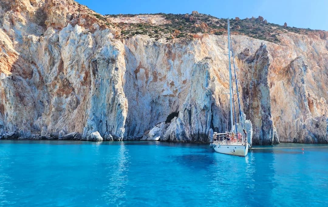
Photo by Derek Nielsen on Unsplash
Cyclades vs Ionian vs Dodecanese: What Actually Changes Afloat
Wind and sea-state: exposure vs lee sailing
The Cyclades are the reason the Aegean has a reputation. In June–August, the Meltemi (Etesian) blows predominantly N–NE, and “20–30+ kn” is not an outlier week; it’s a planning baseline. The distances might be 15–25 nm between islands, but the water between them is often open channel with acceleration zones and steep, short seas when you’re punching north.
The Ionian is a different planet in July–August: many areas see ~10–20 kn afternoon sea-breezes (route dependent), with calmer mornings and less punishing chop. You can run a week on 8–18 nm hops, swim twice a day, and still make dinner ashore without everyone walking like they’ve ridden a mechanical bull. The Dodecanese sits in between: fewer “constant head-sea” days than the Cyclades on some routes, but expect 20–40 nm legs between island groups, plus occasional extra motoring when the wind goes light or wrong.
Navigation workload: channels, gusts, and traffic
Cyclades navigation feels “offshore” because committing channels are common, and the consequences of a late start are real. Crossings like the Kafireas/Cavo D’Oro area can build ugly sea state in N–NE, and a 25 nm leg can become 5 hours of wet reefing practice. That’s why I tell mixed crews to treat 15–30 nm as a comfortable Cyclades day range, not because the boat can’t do more, but because the crew’s shoulders and patience can’t.
Ionian workload is lighter: more shelter, more “Plan B” bays every 5–10 nm, and fewer days when you must commit to an exposed crossing. Dodecanese planning demands discipline: longer legs, fewer mid-passage hideouts, and more attention to fuel range if you’re on the nose. This is where Breezada’s sea distance calculator earns its keep—check the nautical miles for your planned route, then add margin for tacks and headlands.
Berthing style and shore access: quays, marinas, anchorages
Across Greece, town quays with Med-mooring are normal: reverse in, drop anchor, stern lines ashore. In busier ports you’ll also see laid mooring/lazy lines, which are wonderful until they’re not (usually when someone picks one up with the prop). Marinas exist, but they’re concentrated near main bases and hubs, and they’re not where you’ll spend every night unless you like paying for showers you don’t use.
In all three regions you’ll anchor often, typically in ~4–10 m, with 30–60 m of chain out depending on room and forecast. The practical difference is how exposed you’ll be when the wind clocks or wraps around. Cyclades anchorages can go from calm to chaotic when a N–NE funnels; Ionian bays can surprise you with katabatic gusts off steep terrain at night.
Captain’s tip: Choose your region based on the worst 20% of your days, not the best 80%. Cyclades deliver spectacular sailing—but they also demand earlier starts, shorter hops, and a crew that’s fine being salty.
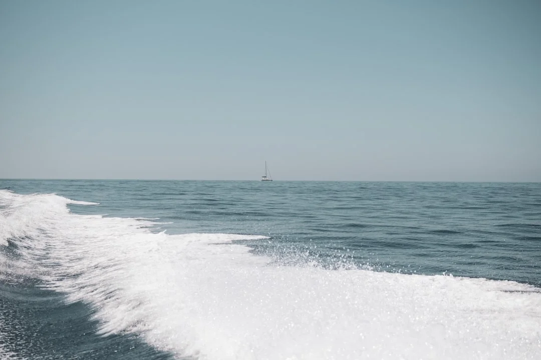
Photo by Iason Raissis on Unsplash
Best Time to Go: Meltemi Strategy, Crowds, and Water Temps
Seasonal wind patterns and what they mean for itineraries
For sailing Greece best time to go depends on what you’re trying to optimize: wind, warmth, or elbow room. In the Cyclades, June–August is Meltemi season, with frequent 20–30+ kn days and the kind of short, steep sea that makes a 30 nm “day sail” feel like a delivery. That’s not a reason to avoid summer, but it is a reason to build itineraries that work downwind or on friendlier angles, and to pre-identify refuge ports before you ever cast off.
A practical Cyclades rhythm in Meltemi: leave early, cross open water before the afternoon strengthening, and avoid committing to big channels late in the day. If you’re forced to beat, keep it short and pick arrivals with wide entrances and room to reset. I also like an “absorber day” midweek: a deliberate 0–10 nm reposition or a lay day, because fatigue is cumulative when you’re reefed all week.
Shoulder season vs peak: comfort, availability, and pricing
Shoulder season (often May–early June, or September) is where families and first-timers get the best trade: warmer water than you’d expect, less quay chaos, and fewer days when the wind dictates every decision. Peak season July–August is when the Greek islands are at full volume: anchorages fill, town quays become competitive, and arrival timing matters. In popular Cyclades ports, arriving by 14:00–16:00 materially improves berth success; show up at 18:30 and you’ll be doing creative geometry with tired crew.
Money follows the crowds. Bareboat charter Greece cost can run ~2–3× higher in July–August than shoulder season for the same boat, especially in the 38–46 ft band that most crews want. If your crew is wind-hungry and competent, peak summer can be glorious. If your crew wants relaxed swims and easy nights, shoulder season in the Ionian is the closest thing sailing ever gets to cheating.
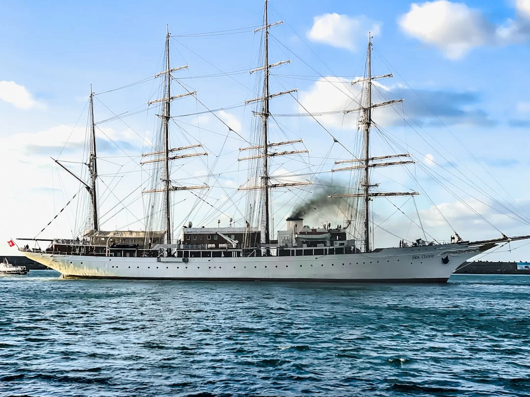
Photo by Evangelos Mpikakis on Unsplash
Route Planning & Greek Island Sailing Distances (NM & Time)
How to turn a ‘wish list’ into a safe weekly loop
Route planning starts with humility: the islands don’t care about your restaurant list. Pick your base, then sketch a loop that works with the prevailing flow—N–NE in the Cyclades in summer, lighter thermals in the Ionian, and mixed angles in the Dodecanese. Next, identify the most exposed segment you must cross, because that segment sets your week’s difficulty more than the average distance does.
Once you have a draft, run the real Greek island sailing distances between waypoints, not “as the crow flies.” Breezada’s sea distance calculator is ideal here: calculate the distance between ports base-to-stop, stop-to-stop, and bail-out-to-bail-out so you can see where you’re committing. Then add margin for tacking (often 10–30% on a beat), plus 0.5–1.0 hour for harbor approaches, traffic, and the inevitable “where’s the lazy line?” moments.
Distance-to-time math and realistic daily hop targets
The only formula you need is: hours = distance (nm) ÷ average speed (kn). On typical charter boats, plan ~5–7 kn under power and ~5–7 kn average under sail on mixed legs, acknowledging that head seas can knock that down fast. A 25 nm leg at 5.5 kn is 4.5 hours before detours and docking. That’s why I call 30 nm “big” in the Cyclades when you’re reefed and bashing; the clock isn’t the only limiter, the crew is.
Region targets that work in the real world: Cyclades mixed-crew comfort 15–30 nm, Ionian often 8–20 nm, and Dodecanese commonly 20–40 nm between key stops (route dependent). In peak season, also budget time to arrive early—again, 14:00–16:00 is a sane target when quays fill.
Bail-out ports, turn-back points, and no-go channels
Every day should have a “no shame” option. In tougher areas, I like at least one refuge every 10–15 nm—a port you can enter safely in 25–30 kn, with room to reset the anchor and decent holding. Mark turn-back points: headlands where the sea state changes, or where continuing commits you to a long lee shore.
Also be honest about channels you shouldn’t cross at the wrong time. Kafireas/Cavo D’Oro is a classic example where N–NE can stack up; if the forecast says 25–30 kn and you’re late, don’t negotiate with it. Your best “seamanship upgrade” in Greece is a disciplined alarm clock, followed closely by using Breezada’s sea distance calculator to quantify your options before you’re already tired.
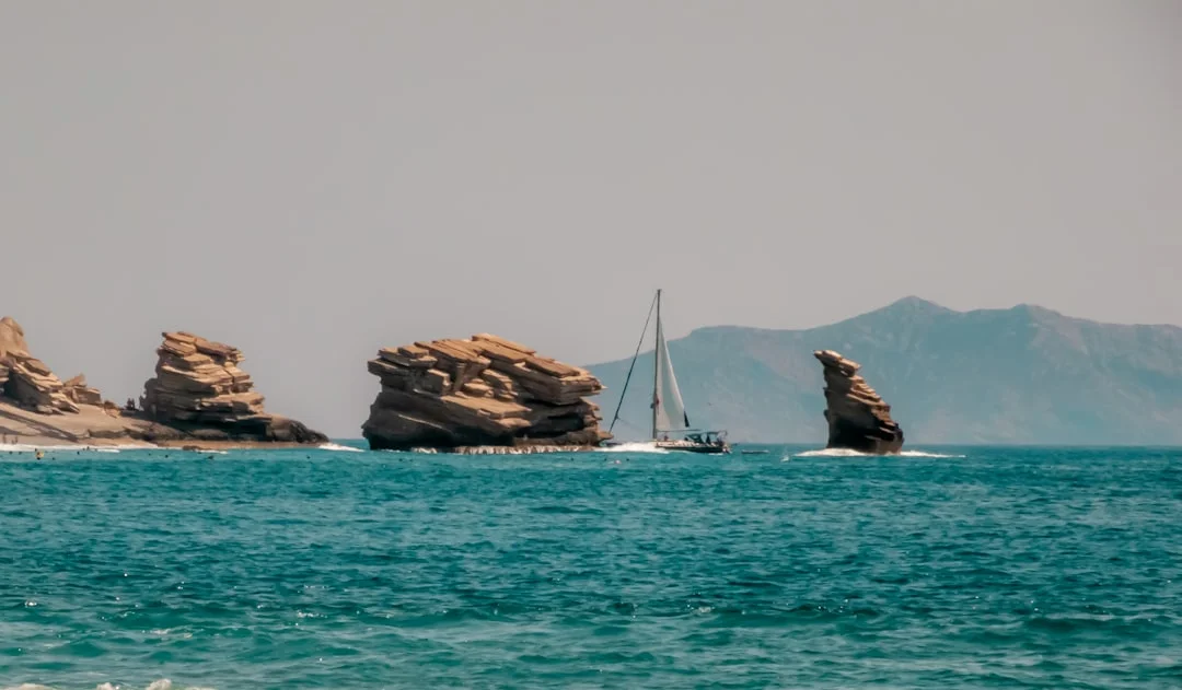
Photo by Evangelos Mpikakis on Unsplash
Cyclades Sailing Itinerary (7 Days): Wind-First Routes & Anchorages
Plan A (normal Meltemi): downwind progression and short hops
For a Cyclades sailing itinerary, I prefer starting from Lavrio when possible because you’re closer to the first islands, but Alimos works if you accept a longer initial leg. Plan A assumes typical June–August patterns: frequent 20–30+ kn N–NE, with stronger afternoons. The bias is north-to-south or southeast progression so you’re not hard on the wind for hours.
A practical 7-day structure (nm are approximate and should be confirmed by your routing and harbor choice): Day 1 Lavrio → Kea ~12–18 nm; Day 2 Kea → Syros ~25–35 nm (consider a shorter intermediate stop if crew is green); Day 3 Syros → Paros/Anti-Paros ~15–25 nm; Day 4 Paros → Naxos ~10–15 nm; Day 5 Naxos → Koufonisia/Schinoussa ~10–20 nm; Day 6 back toward Paros or Syros ~20–30 nm; Day 7 return toward base ~25–40 nm depending on start point. If those numbers feel “small,” remember the sea state makes them honest.
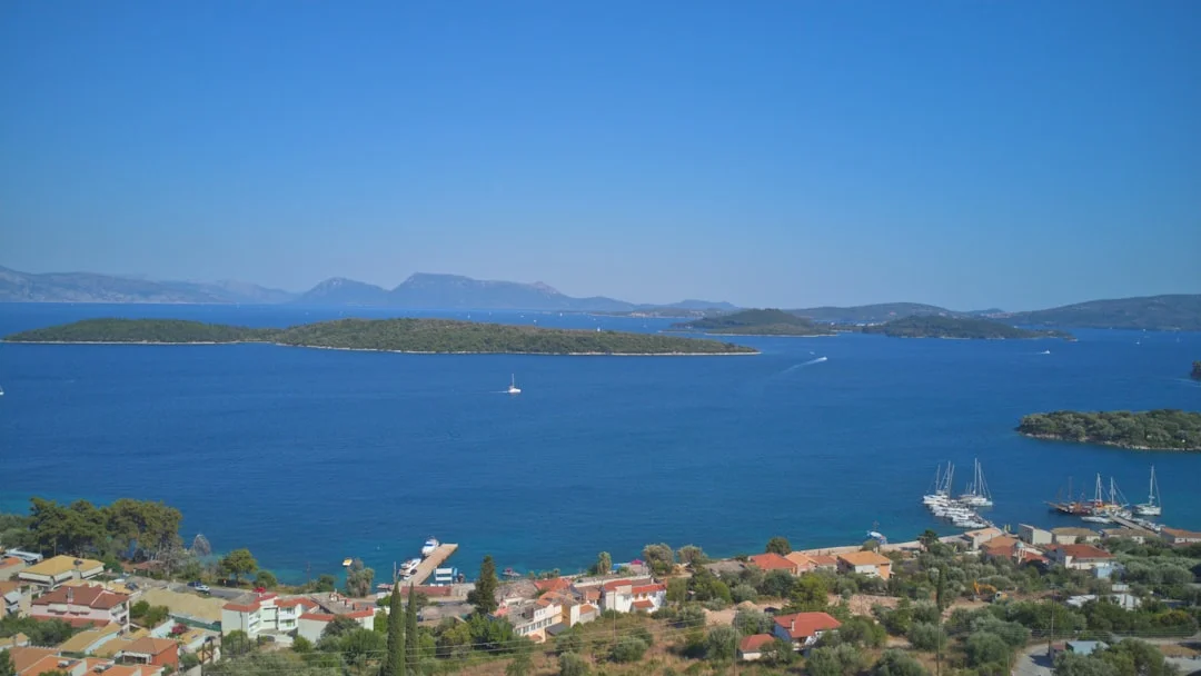
Photo by Zeevlam on Unsplash
Plan B (strong Meltemi): lee ports, no-commitment legs, rest day logic
When it’s blowing 25–30+ kn for days, Plan B is about lee and containment. You shorten legs to 8–18 nm, stay behind big islands, and avoid long exposed channels after lunch. You also build a deliberate refuge day: a port with services, groceries, and a harbor you can sleep in without a rolly anchorage.
This is where crews get into trouble by “just pushing on” because the next island is only 18 nm away. In a head sea, 18 nm can mean 4 hours of slamming, then a rushed Med-moor with tired hands and short tempers. I’d rather do 0–10 nm to reposition, anchor in 4–6 m on sand, and let the crew recover. Your holiday does not get a trophy for suffering.
Anchorage notes: depth, holding, and wind wrap
In the Cyclades you’ll commonly anchor in ~4–10 m, and you’ll typically deploy 30–60 m of chain depending on swing room and forecast. The seabed is often sand with posidonia patches; set the hook on sand, not in weed, and snorkel-check if you can before nightfall. A typical charter setup is an anchor in the 15–25 kg range with 8–10 mm chain and 50–80 m carried, but don’t assume your boat matches the brochure—verify at handover.
Wind wrap is the Cyclades gotcha. A bay that’s perfect in N can become uncomfortable when the wind bends around a headland and turns into gusty bullets from NE. Pick anchorages with clear protection logic, and always ask: “What happens at 02:00 if it clocks 20 degrees?” Also, remember peak summer quay reality: Med-moor berths can fill by mid-afternoon, so target 14:00–16:00 arrivals and pre-rig stern lines and fenders before you enter.
Captain’s tip: Reef early, then reef again. In Meltemi, a conservative sail plan saves energy for the part that actually breaks boats: docking.
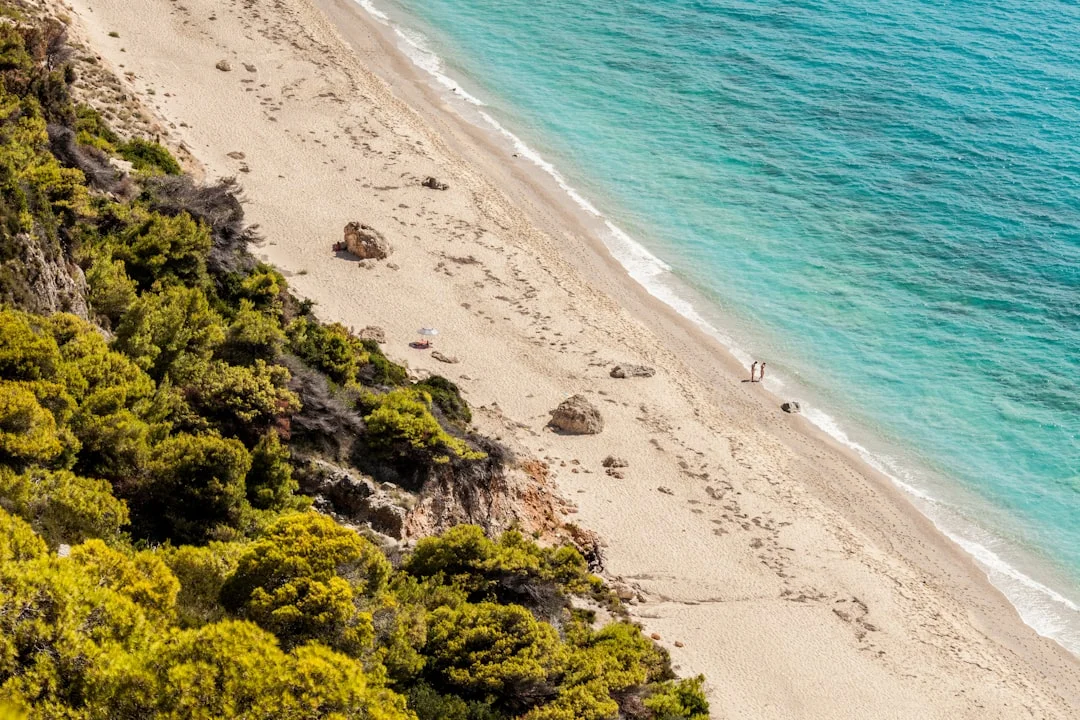
Photo by Nemanja .O. on Unsplash
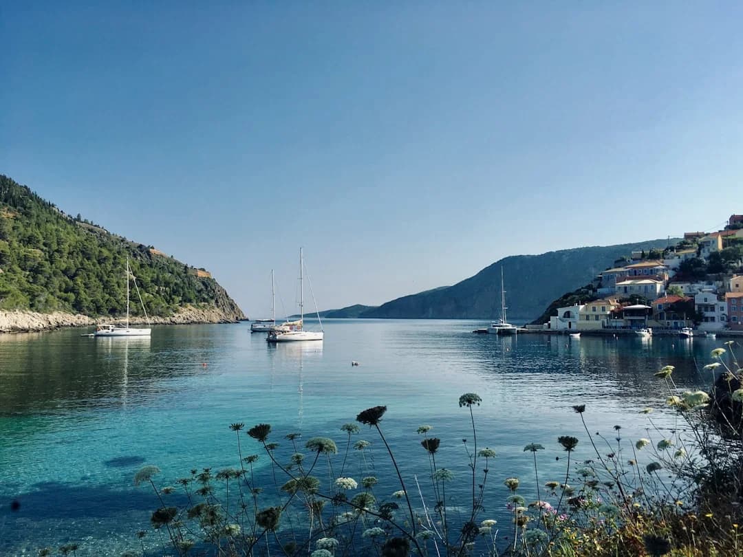
Ionian Sailing Route (7 Days): Short Hops, Swim Bays, Easy Mooring
The Ionian sailing route is where I send crews who want confidence, not combat. Bases like Lefkas and Corfu offer easy access to sheltered waters, frequent stop options, and plenty of bays where anchoring is straightforward. In July–August, plan for ~10–20 kn afternoon sea-breezes (route dependent), with mornings calm enough for provisioning, check-outs, and unhurried departures.
A solid 7-day loop from Lefkas might keep most legs in the 8–18 nm range: Day 1 Lefkas area → Meganisi bays; Day 2 Meganisi → Ithaca; Day 3 Ithaca → Kioni/Frikes area and nearby anchorages; Day 4 across to Kefalonia (short hop with options); Day 5 toward Atokos or sheltered bays for swimming; Day 6 return through the inside channels; Day 7 back to Lefkas for checkout. You can tighten or loosen it daily because bail-outs are frequent, and you’re rarely forced to cross big, exposed water. Use Breezada’s sea distance calculator to sanity-check legs and ensure you’re not accidentally planning a “small” day that becomes 30 nm with detours.
Anchoring is commonly 4–10 m, with 30–60 m of chain out depending on crowding and gusts. The Ionian’s practical risk isn’t constant big wind; it’s surprises: katabatic gusts rolling off steep terrain at night, and anchorages with weed patches that look like sand until your anchor skates. Set with progressive load, verify your transits, and don’t be shy about moving if the crowd squeezes your swing room.
Berthing is often easier than the Cyclades because anchoring out is comfortable, but town quays still get busy in peak weeks. Lazy lines are common in some ports; keep a boat hook ready, brief the crew on prop-foul risks, and treat docking as a procedure, not a performance.
Dodecanese Sailing Itinerary (7 Days): Longer Legs, Culture Stops, Refuges
Route structure: island clusters and committing legs
A Dodecanese sailing itinerary often starts from Kos or Rhodes, and it rewards crews who plan “clusters” rather than pinballing. The key is accepting that some legs are naturally longer—20–40 nm between island groups is normal—and choosing commitment days with clean forecasts and early departures. If the Cyclades teach reefing, the Dodecanese teach schedule discipline.
A workable 7-day structure might include: Kos → Kalymnos or Pserimos (~15–25 nm depending on route), then toward Leros (~15–25 nm), then a longer push toward Patmos (~20–35 nm), and back through a different line of islands to reduce repetition. Passage times are simple math: at 5–7 kn, a 35 nm leg is 5–7 hours before harbor time. That’s a full day, not a “quick sail,” and your crew needs to know it up front.
Wind angles, motoring expectations, and fuel planning
The Dodecanese can feel smoother than the Cyclades at times because you’re not always grinding into the same N–NE head sea. Wind angles vary more on some routes, which can be a gift if you plan well. The trade-off is that lighter winds or an awkward angle can mean more motoring, and that changes both range and costs. For a 38–46 ft charter monohull, typical planning tankage is ~150–250 L fuel and ~300–500 L water—useful ranges, not promises.
At 5–7 kn under power, fuel burn varies wildly by hull, prop, and loading, so the smart move is to track engine hours and refuel when convenient rather than heroic. If your itinerary includes two 30–40 nm motoring-heavy days, you should plan stops with reliable fuel access and avoid ending the week with a “we’ll be fine” margin. Also consider shore power realities: marinas generally provide 230V/50Hz; smaller quays may have limited power or water, or it’s intermittent when everyone plugs in at once.
An alternate bad-forecast plan in the Dodecanese is to shorten exposed legs and sleep closer to refuge ports, even if it means skipping a headline island. Culture is better enjoyed when you’re not arriving late, low on fuel, and arguing about whose turn it is to catch the lazy line.
Anchorages & Med-Mooring in Greece: Technique, Scope, Lazy Lines
Anchoring: reading bottom, setting, and verifying holding
Greek anchorages are often shallow enough to make good seamanship easy—if you use it. Expect ~4–10 m depths in many bays, with sand broken up by posidonia/weed. You want sand, full stop, because weed can let your anchor skate until the wind pipes up at 02:30 and you discover you’ve been “anchored” by optimism alone.
My routine: slow pass to read water color, choose a sand patch, drop, then back down progressively—first at idle, then at 1,500–2,000 rpm (boat-dependent) once the chain is straight. If visibility allows, snorkel-check before dusk and confirm you’re buried and aligned. For scope, constrained bays might force 3:1–5:1, but in open roadsteads or stronger overnight forecasts I prefer 5:1–7:1 if room allows.
Med-mooring step-by-step: anchor drop, stern lines, and spacing
Med-mooring is standard at Greek town quays: reverse in, drop anchor, stern lines ashore. In many places you’ll drop the hook 25–45 m off the quay in 3–8 m depth (port dependent), then back in under control. Your typical scope target in port is 3:1–5:1, adjusted for depth and how tight the harbor is.
A clean sequence: pre-rig fenders low and wide, stern lines led outside everything, and a clear hand-signal plan. Approach slowly, stop where you want the anchor, drop decisively, then reverse with enough revs to steer, not so many you excavate the harbor. Snub the chain to control drift, correct for prop walk, and aim to land square with room to step ashore safely. If the crosswind is strong, I’d rather abort early than “save it” late.
Avoiding fouled anchors, crossed chains, and lazy-line mishaps
Most Greek harbor problems are preventable. Crossed chains happen when boats drop too close together, or when someone backs in with slack chain and then tries to fix it by adding throttle. Fouled anchors happen when you drag the hook across weeds and rocks searching for “somewhere it’ll catch.” The fix is boring: choose your drop spot, set early, and keep steady tension while reversing.
Lazy lines deserve respect. Identify the pick-up line early, keep it forward of the prop at all times, and assign one crew member whose only job is lazy-line management with a boat hook. If you feel resistance while maneuvering, go to neutral before you buy yourself a diver’s bill. Greece has excellent underwater help in many ports, but you’ll spend €50–€150 (or more) learning a lesson you could’ve avoided with a 10-second pause.
Captain’s tip: Brief roles before you enter the harbor. In a Med-moor, silence is expensive and shouting is a sign you didn’t prepare.
Costs, Fees & Compliance: Budgeting a Greece Sailing Week
Charter pricing, crewed add-ons, and hidden line items
Budgeting starts with the charter fee, but that’s only the first bite. In Greece, weekly bareboat pricing is strongly seasonal; July–August can be ~2–3× shoulder season for the same boat. On top of that, add skipper (€180–€250/day + food) and hostess/cook (€150–€220/day + food) if you’re buying stress relief and better meals. In my experience, a skipper is cheapest when you actually need one, and most expensive when you pretend you don’t.
Here are realistic bands you’ll see advertised, before the usual extras and deposits:
| Boat type | Shoulder season (typical) | Peak season (typical) |
|---|---|---|
| 38–41 ft monohull | €2,000–€3,800 / week | €4,500–€6,500 / week |
| 45–46 ft monohull | €3,500–€6,000 / week | €7,000–€9,500 / week |
| 40–42 ft catamaran | €4,500–€7,500 / week | €9,000–€12,000 / week |
Marina/town quay fees, water, electricity, and fuel realism
Your nightly spend depends on how often you anchor out. If you do quays most nights, plan more fees and more time docking; if you anchor most nights, plan more water management and more attention to holding. For fuel, €150–€450/week is a sensible range for a 38–46 ft charter yacht, depending on motoring hours and generator use.
Nightly berthing and utilities vary by location and season, but these bands keep expectations honest:
| Cost item | Town quay / small port (typical) | Full-service marina (typical) |
|---|---|---|
| Berth fee (night) | €10–€35 | €30–€80+ |
| Water | €5–€20 per fill or €2–€8/m³ | €2–€8/m³ (often metered) |
| Electricity | €5–€20 / night | €5–€20 / night (or metered) |
If you’re planning routes with longer legs (especially Dodecanese), use Breezada’s sea distance calculator to estimate your fuel needs based on the voyage distance and build a fuel plan that doesn’t rely on “we’ll find a pump.” It’s not the Aegean that ruins budgets; it’s the last 24 hours when you’re short on time and forced into marinas.
Port/immigration basics and onboard safety expectations
Greece’s territorial sea is 6 nm, and foreign-flag leisure craft arriving from abroad must comply with Greek port/immigration rules as applicable, typically handled by the Hellenic Coast Guard/Port Police. Requirements vary by entry point and boat status, so treat online anecdotes as entertainment, not procedure. If you’re chartering locally, your operator will usually brief you on paperwork expectations; still, confirm what you must carry onboard.
On safety, expect baseline charter compliance: 1 lifejacket per person, functioning fixed VHF (often with DSC), flares, and a documented safety briefing. For a technical reality check, EU charter boats often reference CE categories tied to ISO 12217 (stability), and sensible operators maintain electrical and fire systems consistent with ISO 13297 / ISO 10133 and ISO 9094 principles. I also like ABYC E-11 as a best-practice yardstick, even outside the US, because electricity is universally unforgiving. Finally, COLREGS are not optional—Greek harbors get tight, fast.
Frequently Asked Questions
For a 40–45 ft monohull averaging 5.5 kn, how long should I plan for a 28 nm Cyclades leg including tacking margin and harbor approach time?
Base time is 28 ÷ 5.5 ≈ 5.1 hours. Add 10–30% for tacking on a beat (say 0.5–1.5 hours), plus 0.5–1.0 hour for approach, traffic, and docking setup, and you’re realistically at 6.0–7.5 hours. In 20–30+ kn with head seas, plan the high end and leave early.
In a crowded Greek harbor Med-moor, what anchor-drop distance and chain length are realistic when backing to the quay in 4–6 m depth without crossing chains?
A common setup is dropping 25–45 m off the quay in 4–6 m depth, aiming for 3:1–5:1 scope depending on room. That typically means 15–30 m of chain for pure depth math, but you need extra for angle and spacing, so 25–40 m out is often realistic. Keep steady tension while reversing, and abort early if you’re clearly crossing another boat’s line.
How do posidonia/weed patches affect anchor choice, set technique, and minimum scope in 8–10 m depth compared with clean sand?
Weed reduces reliable holding because many anchors skate on top before they bite. In 8–10 m, prioritize finding sand patches, then set with progressive reverse load and verify with transits or a snorkel check when possible. If forced near weed, increase scope toward 5:1–7:1 if room allows and be conservative about overnight forecasts, because a “marginal set” fails when the wind freshens.
What shore-power precautions are recommended on a charter boat with 230V/50Hz (16A) connections to reduce shock and galvanic risk (RCD/ELCI, polarity, isolation)?
Before connecting, inspect the shore lead and plugs for heat damage and ensure the boat has RCD/ELCI-type protection consistent with ISO 13297 principles (and ABYC E-11 best practice). Connect shore power with the pedestal breaker OFF, then energize, and test the RCD using its test button. For galvanic risk, an isolation transformer or galvanic isolator helps, but on charter boats you mostly manage risk by using good cords, dry connections, and not swimming near faulty marina wiring.
When planning a Dodecanese week with 30–40 nm legs, what fuel range is realistic for a 38–46 ft charter yacht (150–250 L) at 5–7 kn under power, and how should that influence routing?
At 5–7 kn, a 30–40 nm motoring leg is roughly 4.5–8 hours, and two such days can chew through a meaningful chunk of a 150–250 L tank depending on burn rate. Treat that tankage as a planning constraint: pick stops with reliable fuel access, avoid stacking multiple long motoring legs back-to-back, and keep a reserve for harbor maneuvering and unexpected calms. Use Breezada’s sea distance calculator to estimate motoring hours per leg and build a fuel plan before you commit to longer crossings.
About the Author
Related Articles

When to Reef: Safe Systems for Simple Cruising
Learn when to reef with safe, simple systems for cruising. Reduce heel, stay in control, and sail smarter—read the guide and reef with confidence.
By Breezada Team
Sailing in Greece: Cyclades, Ionian & Dodecanese
Plan sailing in Greece across the Cyclades, Ionian & Dodecanese. Get routes, tips and best times—read now and start your charter!
By Breezada Team
VHF Marine Radio Channels: DSC Setup & Call Scripts
Learn VHF marine radio channels, DSC setup, and call scripts to stay safe on the water. Read the guide and upgrade your radio skills today.
By Breezada Team
Greece Sailing Itinerary: 7 & 14 Days by Region
Plan the perfect Greece sailing itinerary with 7- and 14-day routes by region. Get tips and start mapping your trip today!
By Breezada Team