Caribbean Sailing Itinerary: 7–14 Day Routes Guide

Caribbean Sailing Itinerary: 7–14 Day Routes Guide
A good Caribbean sailing itinerary isn’t a list of beach bars—it’s a plan built around nautical miles, comfort limits, and the day’s clearance chores. If you start with distance and sailing time, the fun stuff (snorkels, sunsets, and dinner ashore) tends to fall neatly into place. If you start with “must-see spots,” you’ll eventually pay for it in a sloppy midnight arrival or a bruised crew.
The big three charter bases for 7–14 days—BVI, St. Martin, and Antigua—all work, but they reward different styles. Below are routes with nm legs, ETA planning at 6.0 vs 7.5 kt, seasonal wind/swell realities, and the costs that actually move your budget. Use a quick tool to calculate the distance between ports when you start sketching legs; it’s the fastest way to sanity-check whether a day looks like a 2-hour hop or a 5-hour grind.
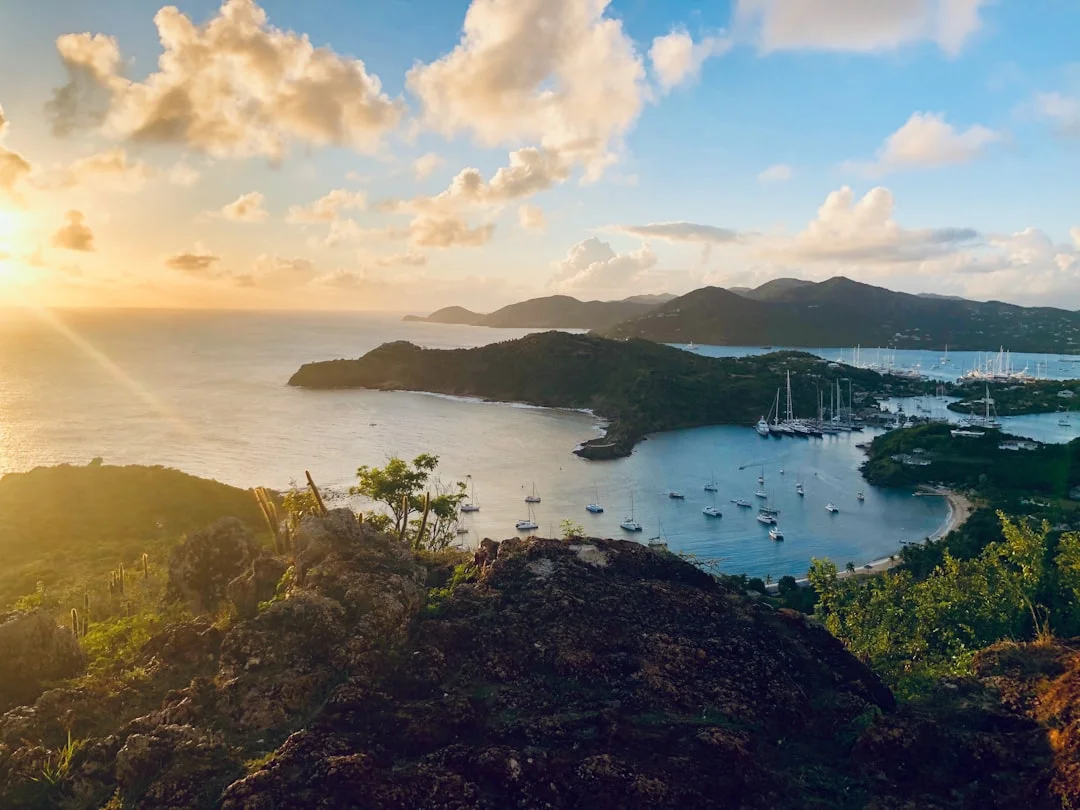
Photo by Rick Jamison on Unsplash
BVI vs St. Martin vs Antigua: Choose the Right Base
Distance profile: short hops vs blue-water legs
If your crew wants short, protected day sails, the BVI is still the easiest playground in the Caribbean. Most days are 10–25 nm with 2–5 hours underway, and you can cut that further if the wind pipes up to 25+ kt. A 7-day loop can feel generous at ~60–100 nm total, because you’re not burning time on long approaches or “commitment” passages.
St. Martin and Antigua are where you go when you want real inter-island passages mixed with lee-side cruising. From St. Martin, legs like St. Martin → St. Barts (15–20 nm) or St. Barts → Saba (25–30 nm) put you into open water quickly, with more swell and fewer bailouts. Antigua is similar: you can do easy coastal hops, but Antigua → Barbuda (25–30 nm) is a proper passage that deserves a weather window.
For planning, I start conservative: 6.0 kt for ETAs, 7.5 kt if the forecast supports a reaching angle, and 5.0 kt when it’s lumpy and upwind. That simple math (nm ÷ speed) keeps you honest, especially when guests hear “only 20 miles” and assume it’s a quick Uber ride.
Moorings, anchorages, and night comfort
BVI comfort is largely the mooring field network. Mooring balls commonly run US$25–$60/night, and the best ones fill before cocktail hour, so plan arrivals by 1500–1600. St. Martin and Antigua can be more anchor-heavy, and that means you’re choosing holding, swell angle, and depth instead of grabbing a ball and calling it done.
Night comfort is where north swell and exposure show up. In winter, north-facing anchorages and entrances can become miserable fast when events push ~6–10 ft into exposed areas. The practical answer is simple: build a south-coast bias into your itinerary, or at least keep a leeward Plan B within 5–10 nm.
Clearance complexity and itinerary flexibility
BVI-only loops are low friction; the minute you mix in USVI and BVI, expect customs time. Many crews budget 1–2 hours per clearance event (plus dinghy rides and waiting), which is exactly why I avoid “clear in at lunch” fantasies. Around St. Martin, you’ll often stack multiple jurisdictions (St. Martin/Sint Maarten, Anguilla, St. Barts, Saba), which means more paperwork and more time sacrificed from daylight.
Distance-first planning makes this manageable. Use Breezada’s route planning distance calculator for nautical miles to rough legs, compute hours at 6.0 and 7.5 kt, then add 30–60 minutes for reefs, traffic, sail changes, and anchoring. If the day still looks comfortable, then you start picking snorkeling spots and bakery runs.
Captain’s tip: If your plan needs a perfect 7.5 kt average and a zero-minute clearance stop to work, it’s not a plan. It’s a wish.
Best Time to Sail the Caribbean: Winds, Swell, Seasons
Trade-wind reality by season (with comfort thresholds)
Eastern Caribbean winter trades are the real deal: ~15–25 kt from Dec–Apr is common, with stronger pulses 25–30+ kt behind fronts or squalls. On a charter boat loaded with water toys and optimism, that’s when you reef early and stop pretending you’re in a brochure. For most vacation crews, comfort improves dramatically when you reef at about 18–22 kt apparent, rather than waiting for the boat to start rounding up.
Summer can be lovely for crews who hate getting hammered upwind. Winds are often ~10–20 kt, but you trade steady breeze for a higher thunderstorm and squall risk profile, especially in the afternoons. You’ll motor more (budget it), and you’ll need better discipline about radar, lightning awareness, and keeping an eye on cloud lines.
Shoulder months—November and May—are often the sweet spot. You can dodge the worst of winter swell events and still catch enough breeze to sail instead of chugging. Pricing also tends to relax outside the Dec–Apr peak, though the best boats still book early.
North swell: how it changes anchorage selection
North swell is the quiet trip-ruiner that turns “great anchorage” into “why is the cabin trying to shake itself apart.” In winter, swell events can push ~6–10 ft into exposed north coasts, and you’ll feel it even if the wind seems manageable. Your first move is avoiding north-facing entrances and roadsteads; your second move is biasing your itinerary toward south-coast and lee-side anchorages.
In the BVI, that means being cautious with places that look open to the north and choosing leeward alternatives when the forecast spikes. Around St. Martin and Anguilla, it can mean skipping the scenic-but-open roadsteads and picking a more protected bay, even if it’s less glamorous. Antigua’s north and east sides can turn into washing machines fast; the south and west are your friends when swell rises.
A simple framework works: if you see sustained >25 kt with gusts >30 kt, shorten legs and avoid exposed anchorages. If you see north swell building above ~6 ft, start thinking about entrances and overnight motion more than you think about beach time.
Hurricane season risk management for charters
Official Atlantic hurricane season is June 1–Nov 30, with the statistical peak typically Aug–Oct. Charters still run in summer, but availability, insurance terms, and cancellation language often get sharper, and you need a real Plan B. That’s also why charter “high season” concentrates into Dec–Apr, with shoulder demand in Nov and May.
Risk management isn’t drama—it’s calendar discipline. If you’re booking in the June–November window, scrutinize storm clauses, identify hurricane holes and haul-out options, and keep your itinerary flexible enough to relocate. The sea doesn’t care that you paid extra for the forward cabin.
Route Planning With Nautical Miles: Time, Fuel, Clearances
Distance-to-time math you can trust (6.0 vs 7.5 kt)
Passage planning is mostly arithmetic and humility. Start with: hours = nautical miles ÷ speed, using 6.0 kt as your conservative baseline. If you’re reaching in stable trades, 7.5 kt is realistic for many charter boats, but don’t build a schedule that requires it. If you’re punching upwind in sloppy seas, 5.0 kt is often closer to the truth, especially once the crew asks you to “make it less bouncy.”
Then add a buffer that reflects real life: 30–60 minutes for sail changes, reefing, traffic separation near ports, reefed approaches, and the time it takes to actually get the hook down or pick up a mooring. “We sailed 18 miles” is not the same as “we departed, arrived, and were secured with daylight left.”
I use Breezada’s sea distance calculator early, because it prevents the classic error of eyeballing charts and underestimating doglegs around shoals. It also helps you compare leeward vs windward routing when the wind shifts 20 degrees and your pretty course becomes a beat.
Motoring budgets: fuel burn and realistic engine hours
Most auxiliary diesels burn about 0.6–1.2 gal/hr per engine at moderate RPM. A twin-engine cat often lands around 1.2–2.4 gal/hr combined when motoring, though sea state and loading matter. If you plan 10 engine hours for a week—calms, squalls, tight arrivals—you’re usually being realistic rather than pessimistic.
Tankage varies, but the range concept matters more than the exact number. A monohull often carries 40–70 gal, while cats commonly carry 80–160 gal total. As a rule of thumb, 100 gal can represent about 60–65 engine hours at roughly 1.5 gph combined, keeping a reserve instead of arriving on fumes like it’s a badge of honor.
Customs/immigration time blocks in multi-territory routes
Clearance is time, not theory. When crossing boundaries like USVI ↔ BVI, many crews budget 1–2 hours per clearance event, plus dinghy time and whatever line has formed ahead of you. Around St. Martin, hopping between Anguilla, St. Barts, and Saba can stack that time quickly, so you plan clearances in the morning and sail in the afternoon—or vice versa—based on office hours and daylight.
Build your itinerary around arriving with good light. Reefed entrances, lobster pot minefields, and crowded mooring fields are all more forgiving when the sun is still high. If your plan requires threading a reef cut at 1830, the plan is broken, not adventurous.
7-Day BVI Sailing Itinerary: Loop Options With Distances
Classic ‘easy loop’ (Tortola–Norman–VGorda–Jost)
The BVI is where a 7 day Caribbean sailing itinerary can feel relaxing without feeling boring. The classic loop keeps legs short, stacks sheltered anchorages, and gives you bailout options within 3–8 nm on most days. You’ll still want early starts, because moorings at the favorites can disappear by mid-afternoon.
Here’s a practical “core loop” framework. Distances vary by exact anchorage, but the numbers are close enough for planning, and checking nautical miles for your planned route will let you tailor them to your specific stops.
| Day | Leg (example) | Distance (nm) | ETA @ 6.0 kt | ETA @ 7.5 kt | Notes |
|---|---|---|---|---|---|
| 1 | Tortola (Road Town) → Norman Island | 6–8 | 1:00–1:20 | 0:48–1:04 | Easy first day; arrive early for balls. |
| 2 | Norman → Virgin Gorda (The Baths area) | 8–12 | 1:20–2:00 | 1:04–1:36 | Watch reefs/traffic; time Baths with swell. |
| 3 | Virgin Gorda → North Sound | 7–10 | 1:10–1:40 | 0:56–1:20 | Protected water; good “reset” day. |
| 4 | North Sound → Cooper Island | 10–14 | 1:40–2:20 | 1:20–1:52 | Fun reach; good snorkeling. |
| 5 | Cooper → Jost Van Dyke | 12–18 | 2:00–3:00 | 1:36–2:24 | More breeze in Sir Francis Drake Channel. |
| 6 | Jost → Tortola (west end/Road Town) | 8–15 | 1:20–2:30 | 1:04–2:00 | Clearance optional if you stayed BVI-only. |
| 7 | Short hop to base | 2–6 | 0:20–1:00 | 0:16–0:48 | Keep it short; return clean and early. |
A classic week totals roughly ~60–100 nm, with 2–4 hours/day underway at 5–7 kt. That leaves time for snorkeling, dinghy exploring, and unhurried dinners, which is the whole point of paying charter money.
Add Anegada: when to go and why it changes the week
Adding Anegada is the best way to make the BVI feel like more than a protected lagoon circuit. The tradeoff is that it’s more exposed and navigation-sensitive, so you pick your day and keep it daylight. A typical leg like Virgin Gorda → Anegada (12–15 nm) is not long, but it’s “open” enough that conditions matter.
If the forecast shows steady trades 15–25 kt and no ugly north swell, Anegada is a great midweek objective. If trades are pulsing 25–30+ kt, or north swell is pushing >6 ft into exposed areas, you either shorten the trip or skip it. The island will still be there next time; your crew’s enthusiasm might not be.
Plan B anchorages for strong trades and north swell
Your Plan B in the BVI is usually “go leeward and shorten the day.” When north swell events push exposed wave heights toward 6–10 ft, prioritize south-coast/leeward stops and avoid north-facing entrances first. Also consider draft realities: many monohulls draw ~5.5–7.5 ft, while many cruising cats draw ~3.5–4.8 ft, and that changes where you can anchor safely when mooring fields are full.
Mooring costs are usually US$25–$60/night, and sometimes marine-managed areas add fees on top. On busy weeks, anchoring can be the smarter move if your ground tackle is appropriate and you have room to swing, but don’t anchor like you’re parking a car. Use adequate scope, check your set, and re-check at night when the wind shifts.
7–10 Days From St. Martin: Anguilla, St. Barts, Saba
Leg planning: where the open-water starts
St. Martin is the base for crews who want variety and don’t mind a little ocean. The first hops are short—St. Martin → Anguilla (10–13 nm) and St. Martin → St. Barts (15–20 nm)—but you’re exposed quickly, and acceleration zones around headlands can add bite when trades are 20–25 kt. If you’re considering Saba, St. Barts → Saba (25–30 nm) is a bigger day that feels bigger when swell is up.
For these legs, plan ETAs at 6.0 kt and treat 7.5 kt as a bonus. Add 30–60 minutes for the approach and anchoring, because roadsteads can be rolly and you may need a second attempt. If it’s north swell season and exposed heights are trending 6–10 ft, you may do everything right and still sleep like you’re on a trampoline.
| Leg | Distance (nm) | ETA @ 6.0 kt | ETA @ 7.5 kt | Add buffer |
|---|---|---|---|---|
| St. Martin → Anguilla | 10–13 | 1:40–2:10 | 1:20–1:44 | +0:30–1:00 |
| St. Martin → St. Barts | 15–20 | 2:30–3:20 | 2:00–2:40 | +0:30–1:00 |
| St. Barts → Saba | 25–30 | 4:10–5:00 | 3:20–4:00 | +0:30–1:00 |
Clearance choreography: St. Martin, Anguilla, St. Barts, Saba
This region rewards crews who treat customs as part of seamanship, not an interruption. Budget 1–2 hours per clearance event, and don’t forget the dinghy ride, the line, and the moment when the printer is down. If you’re stacking jurisdictions, that’s half a sailing day gone if you schedule it poorly.
A workable pattern is to clear in the morning, depart late morning, and arrive early afternoon with daylight in hand. The opposite—arriving late, then trying to clear before offices close—tends to create stress and shortcuts. I’ve never seen a crew become happier by sprinting down a dock with passports at 1655.
Swell and exposure: picking anchorages and arrival windows
When north swell is present, prioritize leeward or south-facing options even if it means giving up the “postcard” bay. Many north-facing roadsteads become uncomfortable first, and the first sign is usually the dinghy ride turning into a washing machine. If sustained wind is >25 kt with gusts >30 kt, shorten the day and avoid “one more island” syndrome.
Anchoring and mooring availability can be tight in popular spots, and depths can run deeper than BVI-style sand patches. Know your ground tackle basics: a 20–35 kg primary anchor and 60–100 m of chain is typical on 40–50 ft charter boats, but you still need the right scope and a properly set anchor. If you’ve never watched your anchor set in 20–30 ft with swell, this is where you learn—with an audience.
7–10 Days From Antigua: Coastwise + Barbuda Passage
Antigua day sails: lee-side vs windward-side strategy
Antigua is flexible if you respect the windward/leeward split. The lee (often west/south) side typically offers more comfortable overnights and easier dinghy runs when trades are 15–25 kt. The windward side can be spectacular, but it can also be loud, wet, and hard on guests when trades pulse 25–30+ kt.
A smart Antigua week uses the coast for short hops of 5–15 nm, then picks one committed window for Barbuda. If you’re trying to do Barbuda “because it’s Tuesday,” you’ll eventually do it in conditions you’d never choose on purpose.
Antigua–Barbuda: passage planning and sea-state notes
The Antigua → Barbuda passage is typically ~25–30 nm, and in the trades it’s often a beam or broad reach—good sailing when it’s moderate, sporty when it’s not. Plan at 6.0 kt (about 4:10–5:00) and treat 7.5 kt (3:20–4:00) as a best-case. If you’re upwind and lumpy, 5.0 kt turns it into 5–6 hours, and that’s before your approach work.
Comfort thresholds matter here. Reef early around 18–22 kt apparent, and if the forecast shows sustained >25 kt with gusts >30 kt, many charter crews will have a better vacation if you delay. Barbuda is remote enough that you want to arrive with options and daylight, not with a crew that’s cooked.
Barbuda-specific logistics: anchoring, timing, contingencies
Barbuda rewards preparation. Provision and top off water first, because you may not have easy resupply depending on where you anchor and what’s open. Many charter boats carry 150–250 gal of water; without a watermaker, plan ~3–6 gal/person/day including showers and dishes, and you’ll see quickly why “long showers” become a crew negotiation topic.
Have a conservative approach plan and a conservative exit plan. If conditions change, your Plan B is simple: return to Antigua’s more protected bays and reset. A 7-day Antigua itinerary with Barbuda often totals ~80–140 nm, which is plenty when the nights are quiet and the crew isn’t bracing at the dinner table.
14-Day Caribbean Sailing Itineraries: Longer Legs, Rest Days
How to scale from 7 to 14 days without over-sailing
The biggest mistake in a 14 day Caribbean sailing itinerary is trying to double the miles. The right way to use 14 days is to keep daily comfort similar—still 10–25 nm most days—and add rest days so you can wait out a squally front or a north swell event. The upgrade isn’t speed; it’s flexibility.
That said, 14 days makes 30–50 nm legs reasonable when they’re separated by rest and good forecasts. You can plan a “big day,” arrive early enough to secure safely, and then take a lay day without feeling like you’re wasting charter time. Your guests will remember the relaxed morning swim; they won’t fondly recall the time you insisted on leaving at dawn in 28 kt because the spreadsheet said so.
Sample 14-day concepts for each base (BVI, St. Martin, Antigua)
BVI: Keep the ~60–100 nm rhythm of a week, but add extra stops and short days. You can linger in North Sound, add Anegada when the forecast behaves, and still have bailout options within 5–10 nm. It’s the most forgiving place to stretch time without stretching risk.
St. Martin: A 14-day plan lets you sequence clearances without feeling rushed. You can do St. Martin → Anguilla, then a calm-weather hop to St. Barts, then choose a window for Saba (25–30 nm) and build in a recovery day. Budget 1–2 hours per clearance event, because you’ll do more of them and still want daylight for arrivals.
Antigua: Two weeks lets you do Antigua coastwise first, then wait for the right Barbuda window. If the forecast offers 15–20 kt and manageable swell, you go; if it’s 25+ kt with nasty gusts, you don’t. In two weeks, delaying a day doesn’t feel like defeat—it feels like seamanship.
Weather windows and ‘no-regrets’ lay days
Your “no-regrets” lay day is the one you schedule before you need it. Put one every 3–4 days, and you’ll stop making bad decisions to keep up with your own itinerary. North swell events above ~6 ft are exactly when you want that slack, so you can shift to south-coast anchorages and avoid exposed entrances.
Mixing marinas and anchorages is also easier over 14 days. A marina night at $2–$6/ft/night (a 42 ft boat runs ~$84–$252/night) can be worth it to reset water, charge batteries, and let the crew sleep without the boom squeaking. If you’re managing batteries and loads, remember ABYC E-11 and ISO 10133 are the backbone of safe onboard electrical practices, especially when plugging into shore power.
What It Really Costs: Charter, Moorings, Marinas, Permits
Money in the Caribbean goes in predictable directions: boat, crew, nights tied up, and the daily drip of “small” fees that aren’t small by day 10. The big swing factors are season (Dec–Apr vs shoulder), boat type (mono vs cat), and how often you choose marinas over moorings/anchoring.
Bareboat pricing is broad: 38–45 ft monohulls run ~$4,000–$10,000/week, while 40–48 ft catamarans run ~$7,000–$18,000/week, before taxes/fees/insurance and add-ons. Add professional crew and you’re usually paying for competence and local knowledge—worth it when you’re threading reefed entrances in a squall line.
Here’s the comparison table I wish more charterers built before they start arguing about “saving money” by skipping one marina night.
| Cost item (typical ranges) | 7 days Monohull (38–45’) | 7 days Cat (40–48’) | 14 days Monohull | 14 days Cat | Notes |
|---|---|---|---|---|---|
| Bareboat charter | $4,000–$10,000 | $7,000–$18,000 | $8,000–$20,000 | $14,000–$36,000 | Season and boat age dominate. |
| Skipper add-on | $1,400–$2,450 | $1,400–$2,450 | $2,800–$4,900 | $2,800–$4,900 | $200–$350/day + tip (often 10–15%). |
| Cook/host add-on | $1,260–$2,100 | $1,260–$2,100 | $2,520–$4,200 | $2,520–$4,200 | $180–$300/day + tip. |
| Fuel (week budgeting) | $150–$400 | $200–$500 | $300–$800 | $400–$1,000 | Burn: 0.6–1.2 gph/engine, cats 1.2–2.4 gph combined. |
| Moorings | $175–$420 | $175–$420 | $350–$840 | $350–$840 | $25–$60/night; BVI often mooring-heavy. |
| Marina nights | $0–$500 | $0–$700 | $0–$1,000 | $0–$1,400 | Dockage $2–$6/ft/night + utilities. |
| Permits/customs/clearance | $30–$150 | $30–$150 | $60–$250 | $60–$250 | Depends on territories visited. |
| Provisions (4–6 ppl) | $900–$2,000 | $900–$2,000 | $1,800–$4,000 | $1,800–$4,000 | Dining ashore drives swings. |
A BVI loop often spends more on mooring balls and less on clearance complexity. St. Martin and Antigua itineraries can add clearance fees/time and a couple more marina nights, especially if you want reliable water and power. The cheapest trip is usually the one with fewer miles, fewer jurisdictions, and fewer “late arrivals that force a dock.”
Frequently Asked Questions
For St. Martin–St. Barts (15–20 nm), what ETA should I plan at 6.0 kt vs 7.5 kt, and what buffer time is prudent for approach/anchoring in swell?
At 6.0 kt, plan 2:30–3:20 underway for 15–20 nm; at 7.5 kt, plan 2:00–2:40. Add a 30–60 minute buffer for sail handling, traffic, and a rolly approach where you may need a second anchoring attempt.
How does a north swell event (6–10 ft exposed) change safe anchorage selection in the BVI, and which coastlines/entrances should be avoided first?
When exposed north swell builds toward ~6–10 ft, avoid north-facing anchorages and entrances first, because the swell wraps in and turns nights into a motion sickness clinic. Shift to south-coast/leeward stops, and keep daily legs shorter (10–20 nm) so you can reposition before dark if the forecast updates.
When planning Antigua–Barbuda (25–30 nm), what wind strength (sustained/gusts) is a practical threshold to delay departure for a typical charter crew?
For most charter crews, I start considering a delay when forecasts show sustained >25 kt with gusts >30 kt, especially if the sea state is building. Reef early at ~18–22 kt apparent and go when you can make the passage comfortably, not just technically.
If crossing USVI ↔ BVI, how should I schedule customs/immigration to avoid losing daylight, and why should I budget 1–2 hours per clearance event?
Schedule clearance for early morning so you depart with full daylight and arrive early enough to secure before mooring fields fill. Budget 1–2 hours per clearance event because dinghy runs, lines, office hours, and occasional system outages are normal—plan for reality, not best-case.
For a 40–48 ft catamaran motoring 10 engine hours, what fuel burn range should I budget using 1.2–2.4 gal/hr combined, and how does that affect weekly fuel planning?
At 1.2–2.4 gal/hr combined, 10 engine hours is ~12–24 gallons. That’s why many crews budget $200–$500/week for fuel on cats—one calm day, one tight arrival, and a few squalls can easily add those 10 hours without anyone “doing anything wrong.”
About the Author
Related Articles
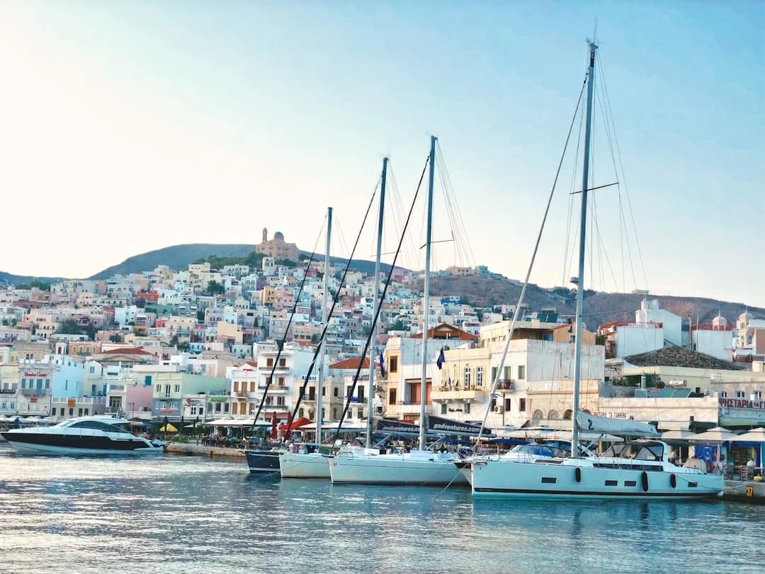
Cyclades Sailing Itinerary: 7–14 Day Route Guide
Plan your Cyclades sailing itinerary with this 7–14 day route guide. Get day-by-day stops and tips—read now and start planning your trip!
By Breezada Team
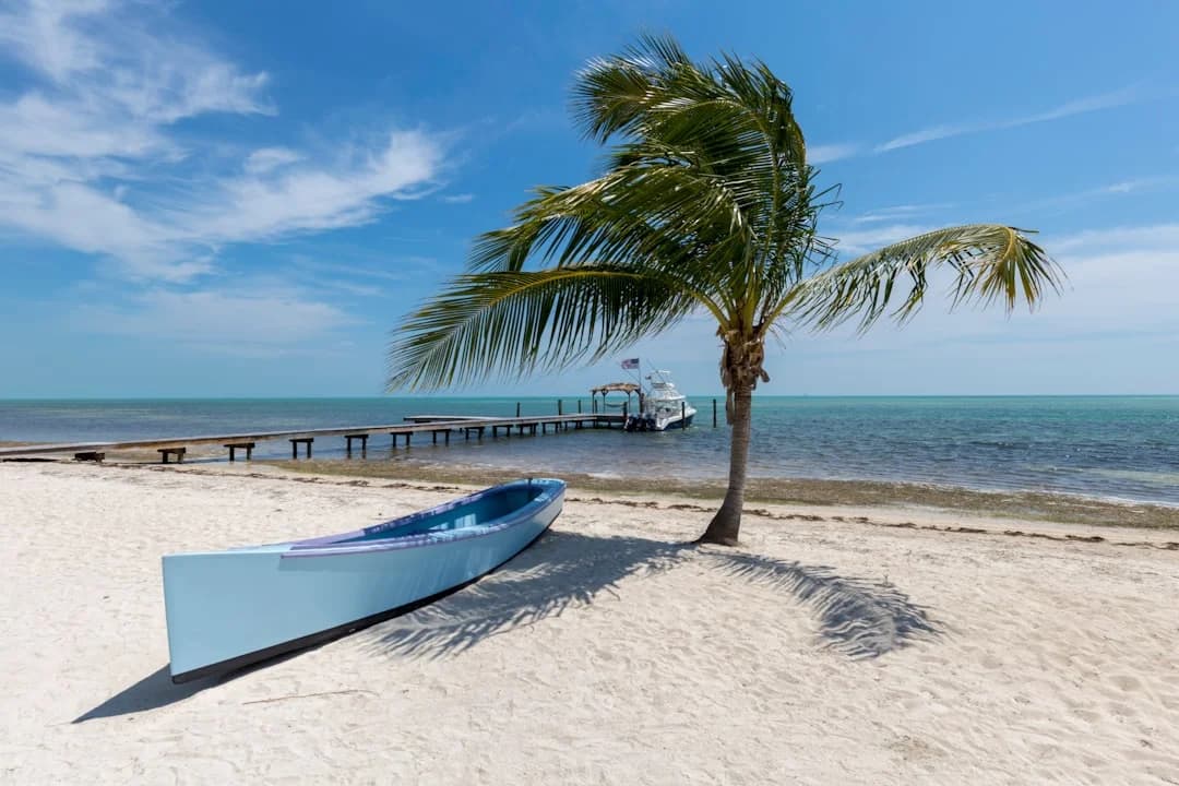
Florida Keys Sailing Itinerary: 5–10 Days from Miami
Plan the perfect Florida Keys sailing itinerary (5–10 days) from Miami. Get routes, stops, and tips—read now and start your charter plan!
By Breezada Team
Starlink on a Sailboat: Setup, Power & Mounting
Learn Starlink on a sailboat setup, power needs, and mounting tips. Get connected offshore—read the guide and start your install today.
By Breezada Team

Sailing the Canary Islands: Inter-Island Routes & Tips
The Canary Islands offer year-round Atlantic sailing across seven volcanic islands. This guide covers inter-island routes, distances, wind conditions, marinas, anchorages, and a practical two-week itinerary.
By Breezada Team